| Stormchase
15th May 2009, OK - Pratt, KS to Medford, OK Report: Clyve Herbert |
|
| Our primary
target today was Pratt, southern Kansas. After experiencing the rapid expansion of severe
storms along a cold front on Wednesday, 13th May which included tornadic supercells, we
were given a second chance to study a similar cold front dipping southeast from Nebraska
and Colorado into Kansas, northern Oklahoma and the Texas Panhandle today. We note a
feature of these cold fronts is that they are a strongly diurnal process of storm
development. Today's trip from Childress to Pratt from early morning to midday, featured strong southerlies and southwesterlies with dewpoints near 20C (68F). Even as we head through Canadian to Perryton and up onto the high Oklahoma Panhandle (800m+ / 2,500'), temperatures remain in the high 20'sC (mid 80's F). Cloud is sparse apart from patchy glaciating thin altocumulus. The synoptic prognosis is for the front to dip into central KS by late morning with its SW alignment reaching into the OK Panhandle and Texas Panhandle. After arriving at Pratt around 1pm, with only patchy low cumulus but a strong S/SW wind, temperatures are n the high 20's(C) / high 80's(F), the DP holding near 20C. We check the satellite image and note that the frontal boundary to the NW of Pratt is showing up a rope signature. Northwest of the cold front, most low level cumulus had disappeared while a broader cumulus field exists ahead of the front. We ventured about 10 miles north of Pratt with the front clearly visible to the NW as a very narrow alignment of enhanced cumulus. As the alignment approached, cumulus cloud structure showed sudden deepening with darker bases extending towards the SW. An area of congesting cumulus just to our north rapidly intensified.The cap today is moderately strong and as temperatures are sustained in the high 80's (near 30C), the cold front is now coming to life. In the upper levels, a moderately strong 500 - 300hPa jet is present. The orientation appears to be from approx 260deg. Within less than half an hour we are located near the frontal boundary northeast of Pratt and watch the explosive development of storms. Huge towers are growing rapidly and the alignment along the frontal boundary of dark bases is now merged in a broadening development. Even as we watch backshearing anvils, rain has not yet reached the ground in our vicinity. Increasingly more frequent thunder becomes merged into a continuous rumble. The wind swings strongly to the northwest. We will now be following this frontal boundary for the next 5 hours as it grows from this modest line of storms to a massive squall line. A heavy precipitation shaft appears to our northeast, and we note the rain free base area starting to curve. Already at this early stage, the massive thunderstorms are affecting the frontal boondy alignment. We move south to keep ahead of the frontal alignment, and the storms continue to expand along the front. Within the next hour, the frontal boundary erupts into massive storms through its entire length through Kansas, into northwest OK and the northern TX Panhandle. As we race south to near Medicine Lodge, the massive cell to our NE becomes tornado warned. We note the pronounced scalloping of the frontal boundary, as downdrafts expand southeast from collapsing storms and inflow notches appear on their southwestern flanks. As we approach Alva, we watch an inflow notch feeding into the severe storm to our northeast and start to rotate. We watch alignments of dust feeding from the north and separate alignments of dust feeding from the south into what appears to be a localised meso circulation. The rain free base rotates rapidly and perhaps, will this be a precursor to a tornadic event?The rotating base then subsides only to reappear several miles to the southwest along the inflow line. This pattern persists for about 10 minutes, then is obscured by precipitation shafts as the cell collapses. Another problem today is the cold frontal boundary continuously overrunning and cutting off sustained uniform inflow. We move quickly south to escape being inundated by rain and hail and try and clear the now strongly developing gustfront, however for a short distance the road bends back into the precipitation shaft and we are pounded by 2.5cm / 1" hail, and then escape as the road winds back towards the south. Not only are we surfing the cold front, we are now leapfrogging the gustfronts..... As we move further southeast, we note the pronounced scalloping of the frontal boundary remains but on a larger scale. We continue east, heading for the I-35 and encounter the deployment of Vortex2 equipment along the way. The squall line was now gaining strength and was producing numerous gustnado developments, some of which were spectacular. We can barely outrun the squall line as we consistently stop to photograph and continue to race east. We encounter on one stop a Vortex2 Doppler radar truck and lots and lots and lots of chasers. The backdrop of the squall line becomes stupendous, and we gather spectacular photographic opportunities. As we approach Ponca City, the squall line finally overtakes us and we turn north along 177 and head for the Kansas border. Another day is done, and we've depleted our adrenaline again....what a brilliant study of an Oklahoma squall line!! Report: Clyve Herbert Photography: Jane ONeill / Clyve Herbert |
|
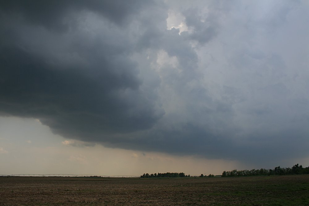
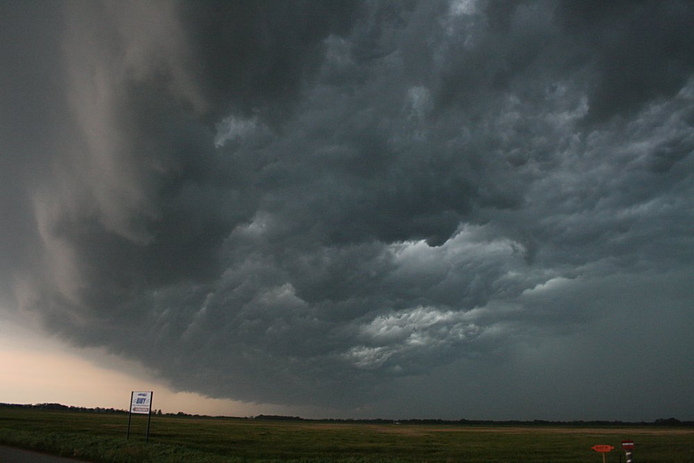
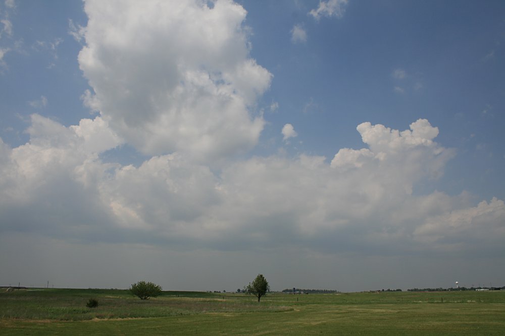 The cold front approaching Pratt, KS around 1.30pm |
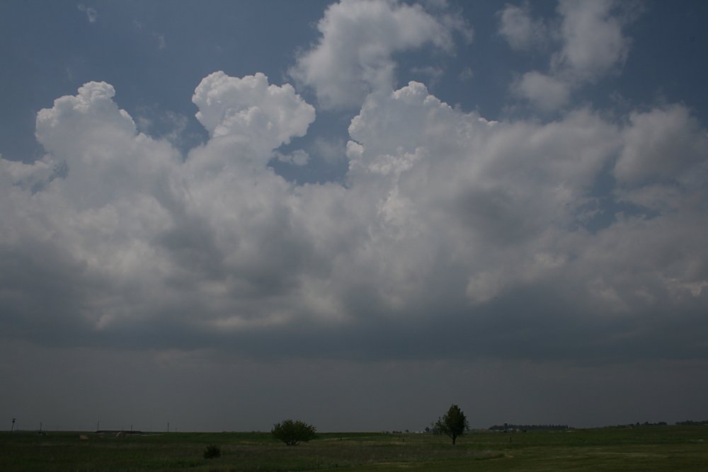 Rapid development of deep cumulus along frontal boundary approaching Pratt |
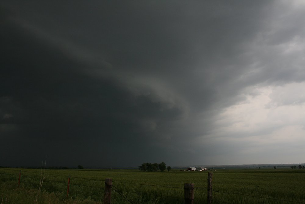
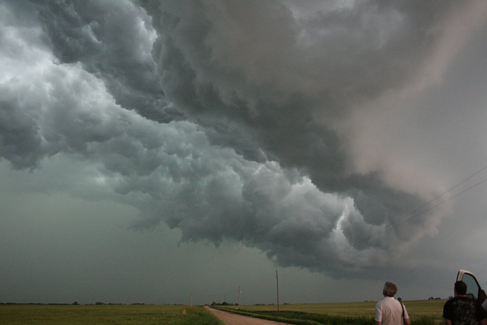
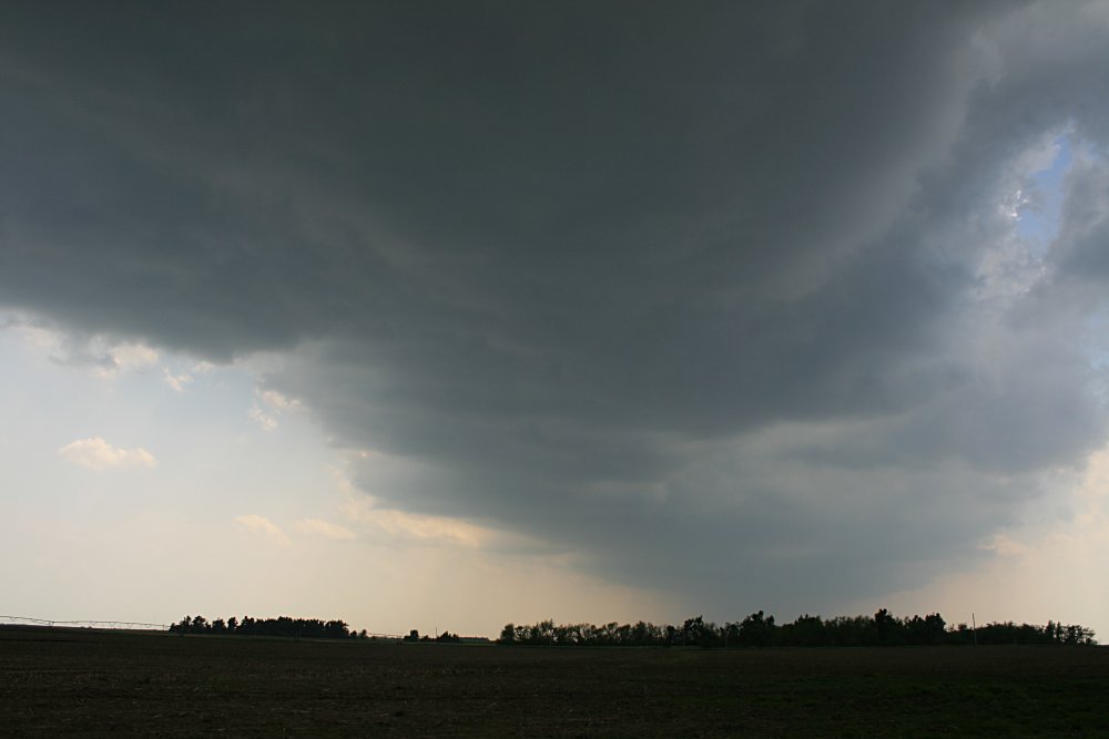 Explosive development of a narrow line of storms along the frontal boundary, NE of Pratt around 2pm |
 Explosive development of a narrow line of storms along the frontal boundary, NE of Pratt around 2pm |
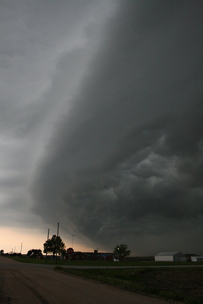
 Tornado warned storm NE of Alva Tornado warned storm NE of Alva |
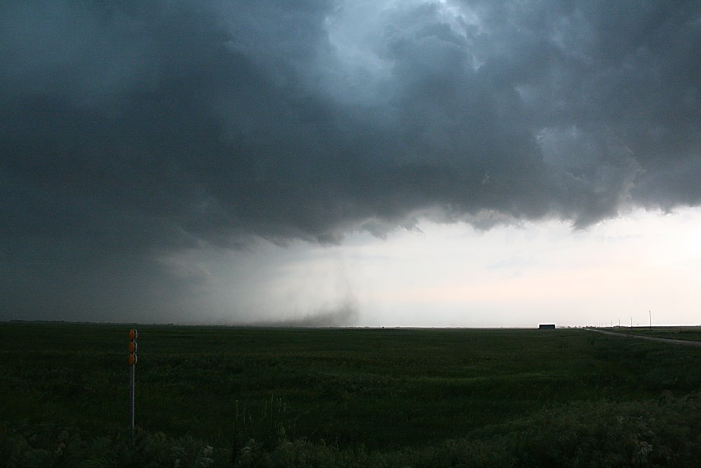 Dust columns curling into a rotating base, NE of Alva, OK |
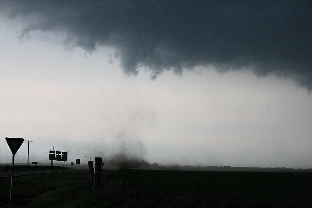 One of the many gustnadoes developing along the squall line |
 Appearance of squall line west of Medford |
 The complex nature of the squall line near Medford |
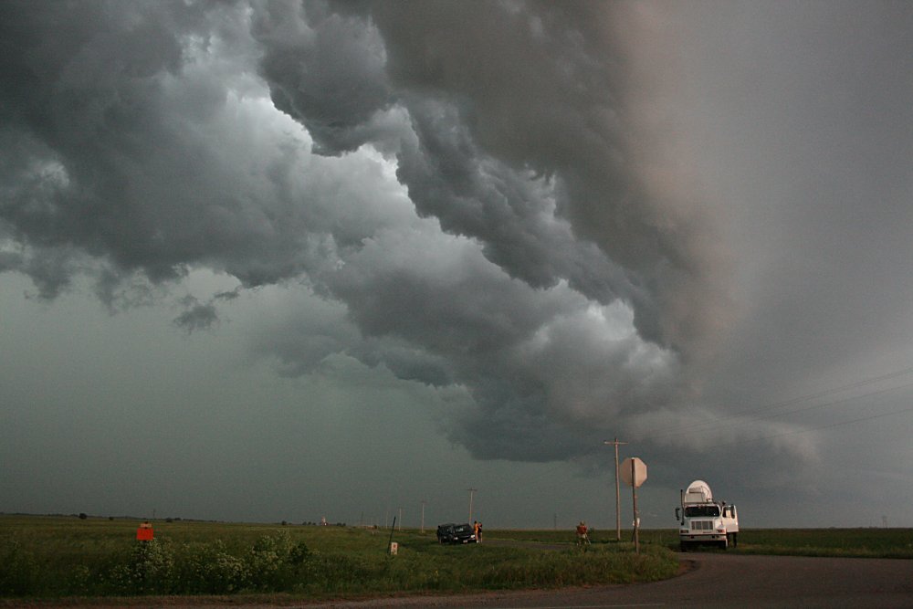
Vortex2 Doppler truck studying squall line near Medford |
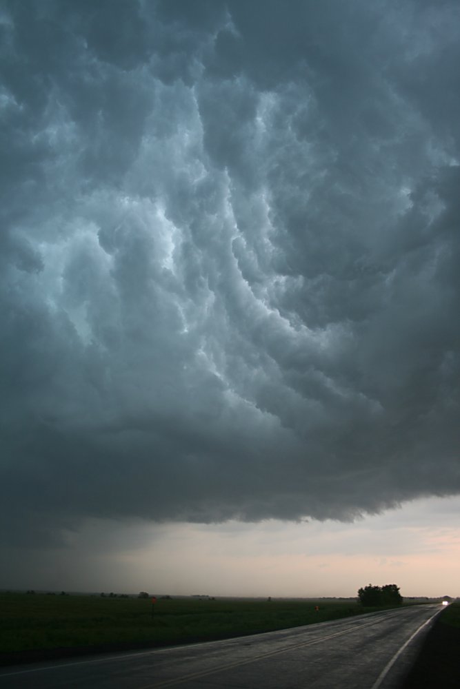
 Stunning imagery east of Medford looking south |
 The vault appearance behind the squall line in the cool air, looking east |