| There's no doubt that the one scent
that permeates the air at Garden City is the smell of cattle feed lots.I suspect though
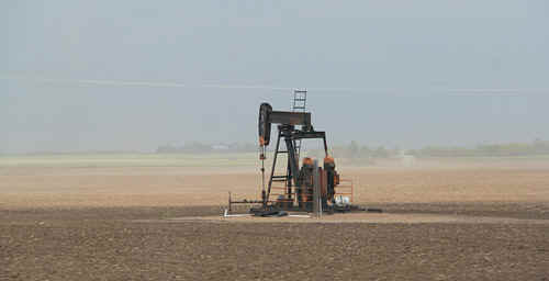
that the Texan oil explorers have 2 ideas of smell...one is that of crude oil the other is
cattle...they both mean money! There was an oil drilling gang who came up to us in the
morning after breakfast...they were curious about the weather station mounted on our
vehicle roof...a pleasant if somewhat hairy bunch of Texan guys with deep Texan drawls.
While I was explaining the workings of the weather station, I thought it was a good
opportunity to find out how deep they drill for oil in these parts. 6,000'!! and then they
force the pipe horizontal...they were whingeing about the previous day's rain - they hated
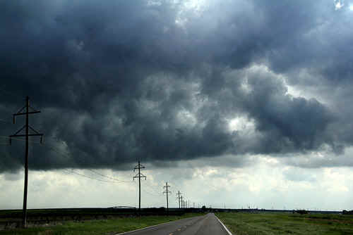
the Kansas mud. I assured them that weather today would be dry in these parts. Looking to the east, we could see the receding dryline with an impressive line of deep cumulus and occasionally thunderheads. The dry air over western Kansas was crystal clear, but today we are going to head east, intercept the dry line and move into moist air coming up from Texas through central Kansas. There was a bit of excitement in the forecasts, with TORCON values being pushed to 8 in SE Kansas. As we pass through the dryline into hazy, murky moisture, there were far too many towers building too early in the day. We continued east to Great Bend to position near the I-135 and wait for larger buildups. Not long after midday, a couple of larger cells developed near our location, but they are struggling and very pulsy in nature. We watch a large cell go north of Lyons and leave it for a new cell developing west of Newton. It's difficult at this time of development to pick the right cell...we opt for the Newton cell primarily because it was located in better moisture and further east of the dryline. We race north on I-135 paralleling the rain free base...... Initially the storm didn't look too good but kept a rain free base on its west side. We pull over at Lindsborg and park to watch the rain free base, now larger, approaching. I'm always interested in large scale rain free bases under thunderstorms...it is here that the focus of the updraft becomes centred. Within 10 minutes, the updraft rain free base is over our heads and promptly drops a funnel. Jane grabs some quick photos and I video...but the funnel collapses in seconds. The storm was teasing and moving rapidly northeast. We're back on the I-135 again and race north to Salina and head east on Interstate 70 to intercept the storm core again. Eventually we turn north and follow the developing wall cloud which rapidly consolidates into a large rotating mesocyclone.We could see a dry slot cutting into the wall area from the west and again fractus near the wallcloud base was rotating rapidly, almost touching the ground. We follow the local Sheriff's vehicle north for a few miles, watching the rotating wall cloud moving rapidly northeast. We then cris-cross the local area using farm and county roads...until we eventually arrive at the bridge repair that blocked our way.....Bridge construction at this time of year is rife across much of the USA...that put an end to our chase. Despite all of the hullabaloo about the day's expectations I find it just as interesting to find out why large and nasty tornadoes didn't develop today.There were just too many cells growing too quickly along the dryline and scavenging for energy. There was very limited convective inhibition (CINH), but that's the way of stormchasing in America - always expect the unexpected. |
|
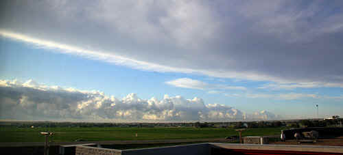 Leaving Garden City, we are west of the dryline. The dryline was marked by a narrow band of enhanced cumulus and overtopped by a narrow band of cirrus. Dewpoints rose from the low 40's to near 60, passing west to east of the dryline. Photo: Jane ONeill |
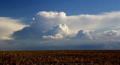 By mid morning the dryline was starting to develop storms across western Kansas. We were at this stage rather surprised at the early convection which indicated a weak cap.Photo: Jane ONeill |
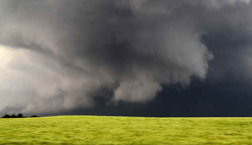
 By late morning, parts of the dryline, looking from west to east became a focus for strong convection. West of Great Bend. Photo: Jane ONeill |
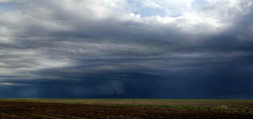 Photo: Jane ONeill |
 We never cease to be amazed at the change in dewpoints when we cross the narrow dryline boundary. Photo: Jane ONeill |
 Its an odd mix when you cross the dryline into moister air...here the southerly is blowing at 25-35knots....and stirring up dust off ploughed fields (paddocks). Photo: Jane ONeill |
 There are always great photo opportunities across the USA...this one was in the middle of Kansas. Photo: Jane ONeill |
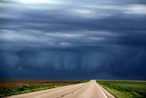
 East of the dryline, there were numerous heavy showers. Photo: Jane ONeill |
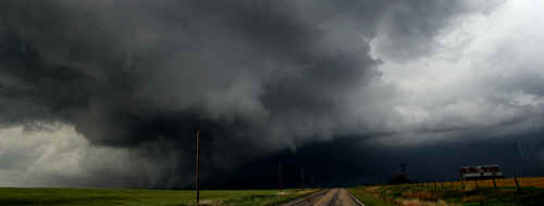
 The impressive flanking line to the Salina supercell was generating brief but violent spinups. It was amazing to see the rapidity of formation and decay in the spinups in the base. The storm simply could not get its act together. Photo: Jane ONeill |
Eventually the storm inflow focus became fractured. Photo: Jane ONeill |
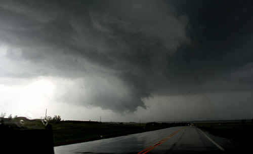 NE of Salina, the storm intensifies generating a large rotating wallcloud area. Photo: Clyve Herbert |
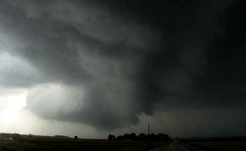 Photo: Clyve Herbert |
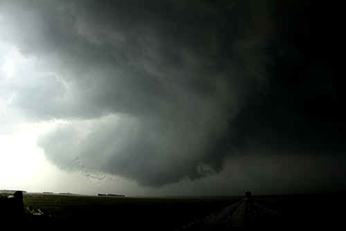 Photo: Clyve Herbert |
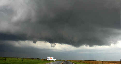 A FedEx truck parked under a portion of the storm flanking line that was rotating. NE of Salina Photo: Clyve Herbert |
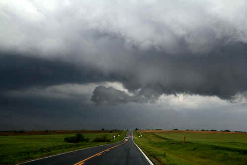 A strong flanking line to the Lindsborg - Salina supercell was marked by sporadic rotation. Photo: Jane ONeill |
 Today storms were having great difficulty consolidating their rotation....despite predictions of strong tornadoes, they failed to materialise. There were just too many stormcells growing along the dryline and interfering with each other. Photo: Jane ONeill |
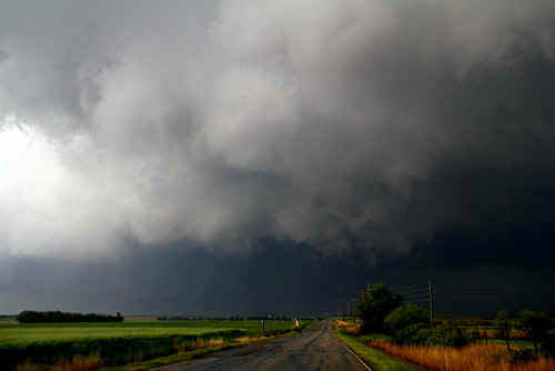
 Near Lindsborg, the wallcloud rotates strongly, sending twisting filaments of vapour to the ground. Photo: Jane ONeill |
 |
|
The chase ends abruptly when we find a bridge is out - no signs, no warnings...we head home...Photo: Jane ONeill |
|
| Stay tuned for the next episode... | |
