| There can often be heated discussion
amongst weather enthusiasts in regards to what type of storms evolve on the day.
Terminology can be a confusing issue for some..."technofibes" can often spill a
bewildering arrangement of scientific explanations which most chasers can understand, but
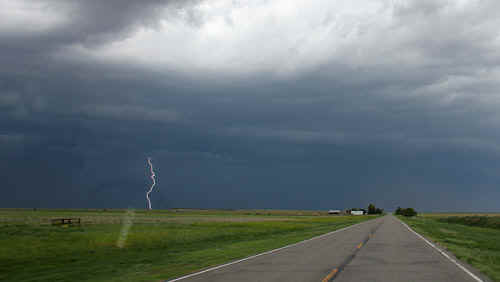
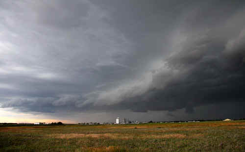
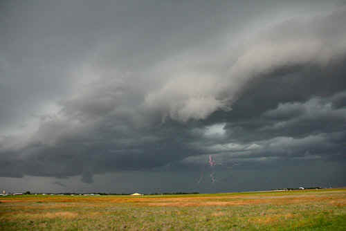
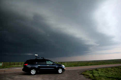
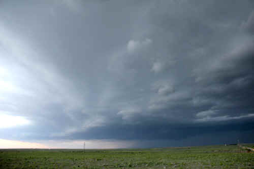
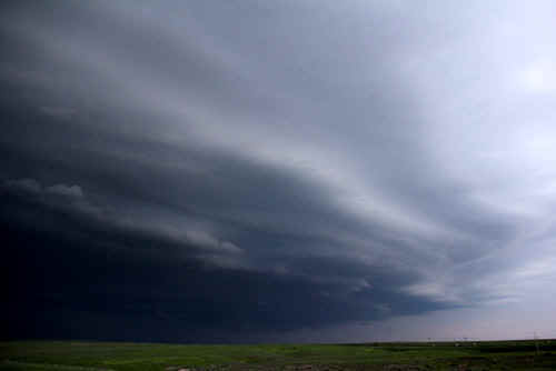
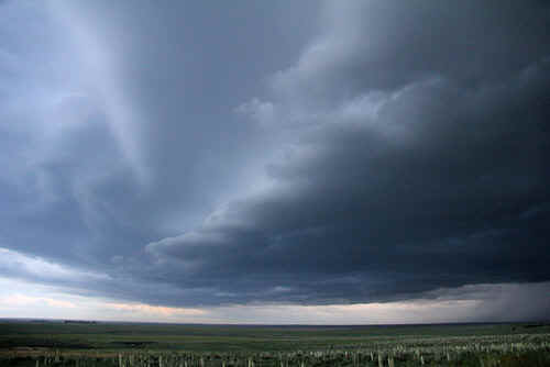
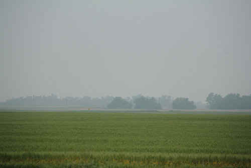
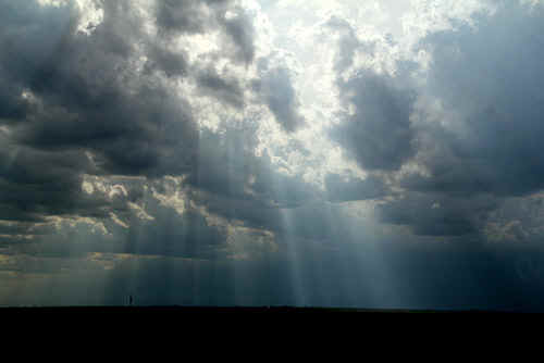
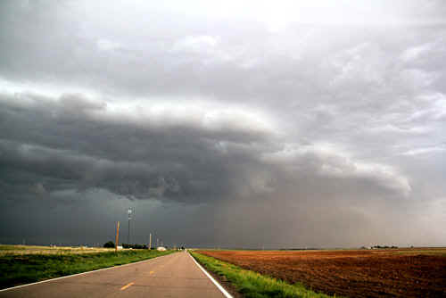
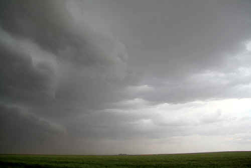
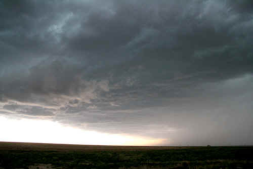
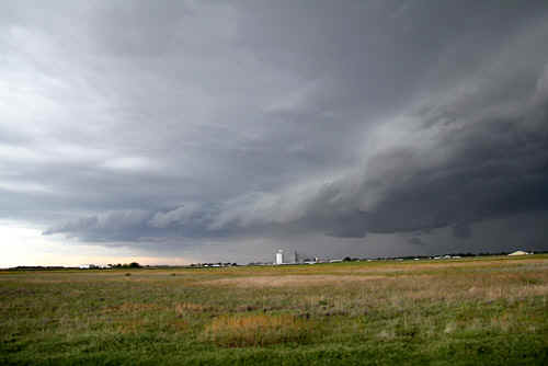
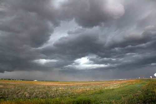
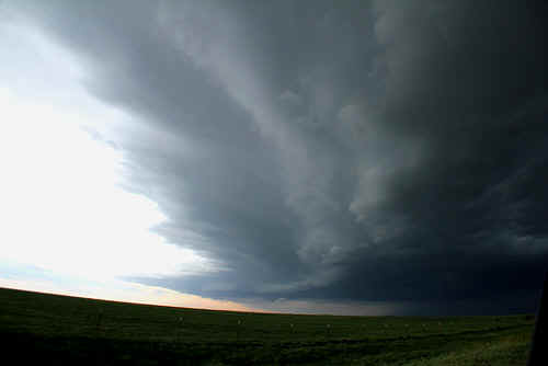
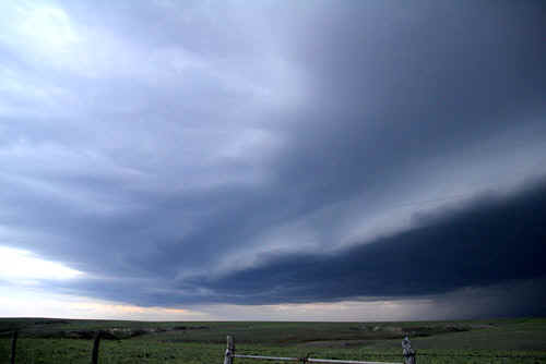
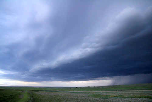
in simple terms, chasers often classify storms thus... LP supercell - low precipitation HP supercell - high precipitation Multicell - conglomerations of various storm cells Without going into a glossary, these are the simple terms used by stormchasers. Other description of storms are: Outflow Dominant or Inflow Dominant. These can often be a confusing description of storm behaviour An outflow dominant storm describes a process where subsidence is the primary forcing mechanism for the storm's life cycle.An inflow dominant storm tends to have a mechanism that provides a more or less steady feed of energy to the updraft (condensation process), but there are so many other issues to describe these two storm types that you could literally write a book. Today, storms were developing along the axis of an upper trough spreading east from New Mexico. The cells developed rapidly along this axis between New Mexico and SW Kansas. This allowed individual cells to combine their outflows along the upper trough axis to produce what became a very spectacular shelf structure. Another feature of the storms today were the exceptionally strong outflow winds at the surface - up to 70mph. There were startling temperature drops along the outflow boundary of nearly 20F...this combined with copious amounts of dust and frequent cloud to ground lightning gave us almost 4 hours of surfing the gustfront. We dodged in and out of the gustfront all the way from SW Kansas to Greensburg, but as in all things weather, changes occur. In the late evening, the alignment of the gustfront tilts more north-south and the very southernmost cell (TailEnd-Charlie) developed a prominent inflow tail. This cell eventually becomes severe with large hail and strobe lightning. We arrive in Greensburg in 50mph outflow gusts and are startled by the wind generator swaying, literally above the hotel.
|
|
 |
 |
 |
 |
 |
 |
 |
|
 |
 |
 |
 |
 |
 |
 |
 |
 |
 |
 |
 |
 |
 |
 |
|
| Stay tuned for the next episode... | |