| Day
10: 1st May, 2010: One of the problems with America is coming across towns with
the same name....Washington is a bit of a dilemma, especially after passing through
Washington, Kansas the day before. Washington, Missouri, although it appears as a small
black dot on the map, was a sizeable town when compared with Australian black dots on the
map. You realise the scale of things here is much larger...including their severe weather!
We head south from Washington today to the 'Arkansas grass'...for those who may remember
the famous song. Unfortunately, the Arkansas grass grows to between 20 and 40m high - and
that's the Arkansas forests! A lot of American chasers will tell you they hate coming into
this state to chase the big storms..but like most Australians, we are willing to try
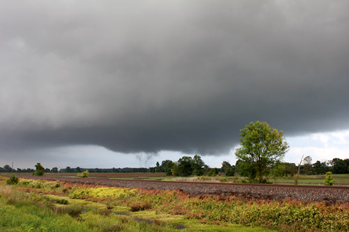
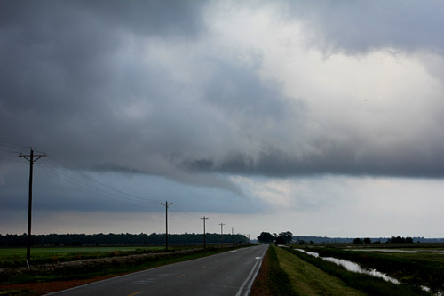
anything once (when it comes to stormchasing).. Our target today is Bald Knob, central Arkansas. On the way through the forests of southern Missouri and Arkansas, the roadway passes through attractive towns with many rivers and creeks, all flowing hard after 2 weeks of good rain. Some of the town names are quite humorous...we refuel at a town called Licking, southern Missouri. To most of us Aussies, that would be a humorous name of a town to live in. Most of the gas stations in the US have clean restrooms...so I enter a clean restroom in Licking...and there scrawled on the wall next to the pan is some graffiti...in proud black texta.."Eric has been alicking in Licking" and an appropriate phone number for contact. We quickly leave Licking behind, and 2.5 hours later we arrive at Bald Knob, Arkansas. It's early afternoon, and very little convection has started except for some popcorn cumulus. From our own analysis, we figured that this was a favoured locality of storm initiation through the afternoon. We move a little further east to Augusta, despite all of the comments about Arkansas trees, we are pleasantly surprised by the large open areas with good viewing and reasonable roads. We notice that most of the fields are full of water....and then discover that this is the heart of rice growing in Arkansas..the things you learn! We note a congesting line of cumulus just to our south (mid afternoon) and we sit and watch for an hour or so. The cold front had lingered across southern Arkansas the previous night and now appears to be retreating northwest as a wavelow develops over NE Texas. The axis of the upper jet is anticipated to cross into Arkansas in the afternoon. The sky is rather murky with what we call Texas haze..contrast is poor and it's difficult to get a perspective on structure, but the alignment of deep cumulus persists. By later afternoon, we find the first echo on radar, just 15 miles from our location. The echo grows rapidly and approaches severe status. We head east to a small locality on H 64 called Fair Oaks and drop south along H 49 to come in behind the storm. Approaching the storm we can see what appears to be a small wallcloud on its southern side. We drive through the rain core and emerge virtually under the wallcloud. It doesn't take long to realise the setup is potent. The lower layers have very high CAPE value and surface humidity is near 80%. We are south of the boundary of the old cold front and we have emerged into fresh southerlies. We park, grab our cameras and video and set up (again). Immediately we notice that the wallcloud is sporadically rotating and isolated rotation is also occurring along the flanking line. We see what appears to be a weak RFD punching down on the SW side of the wallcloud. The setup is rather odd, with sudden and rapid rotation appearing at different parts of the wallcloud. The updraft core rainfree base is inky black and appears to be shifting to the right. Suddenly, the southeast corner of the wallcloud drops groundward...and rotates rapidly and within seconds, produces a multivortex from the ground to the base. We excitedly train our cameras on the spot and video and click away. The multivortex tornado lasts about 2 minutes and promptly dissipates. We pack our gear and race north towards Fair Oaks, but we are diverted east along a side road where we notice the wallcloud rotating rapidly. We pull over on the verge and immediately a horizontal funnel pokes from the side of the wallcloud - rapidly rotating towards the ground. We view this amazing sight for several minutes before it dissipates. We travel further east towards Wynne near Highway 1. Sections of the wallcloud continue to rotate rapidly and minor rotation also appears along the flanking line. The storm is struggling to maintain any form of organised tornadic activity in the long term and we suspect that individual pulses are intensifying the rotation process in the very high CAPE environs in the low and middle level atmosphere. Just when you think that things are starting to fall apart, we view 3 areas of rotation start up between the northern side of the wallcloud and its flanking line. The Fair Oaks storm suddenly drops 2 slender funnels and 1 connects to the ground within seconds - again we are astonished with the rapidity of how tornadoes form in this country. We photograph and video fro the next 5 minutes and watch the storm gradually weaken. The show's over here! Meanwhile, monster supercells are forming in far southwest Arkansas. We head west on H64 and join H167 to head SW. At a town called Beebe, we pull over to watch a fantastic updraft rotate, but it's starting to get dark and we are not keen at getting trapped under this storm at night. We escape back to the highway but we are caught by a phenomenal deluge that blinds us for 5 minutes. We finally emerge and escape to Conway north of Little Rock. We are again drained of adrenaline and collapse. |
|
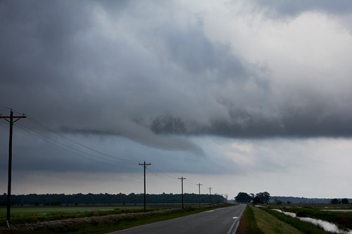
 Under the flanking line - Fair Oaks, Arkansas |
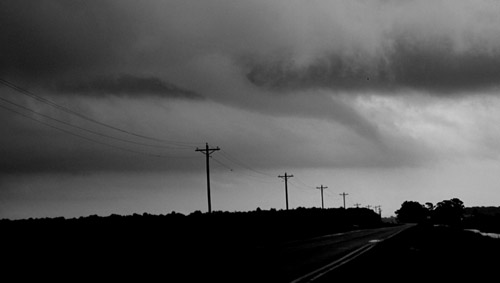
 NW quadrant, weak RFD area |
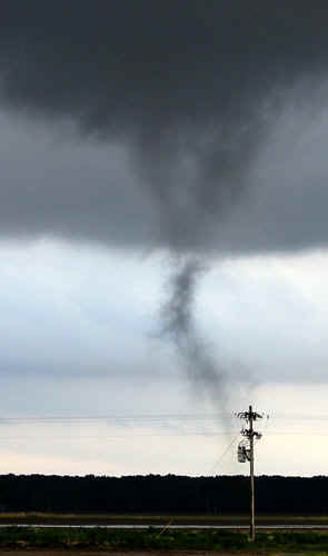
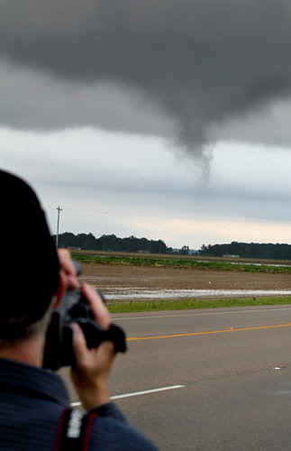
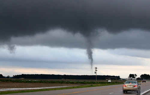
 Developing multi vortex tornado, Fair Oaks under a rapidly rotating wallcloud |
 Multivortex tornado, Fair Oaks |
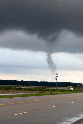
 Close up - Fair Oaks tornado |
|
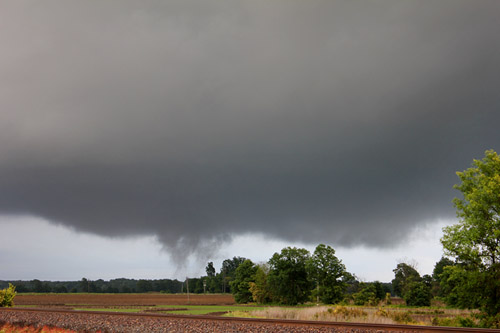 Multivortex tornado, Fair Oaks
|
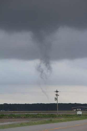
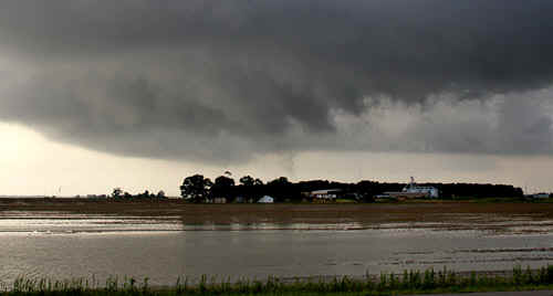
 Developing funnel near Wynne, Arkansas |
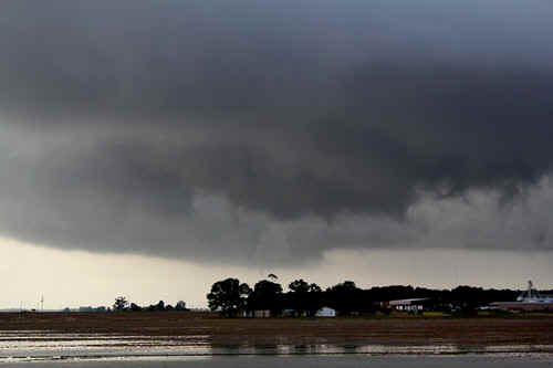
 The Wynne funnel attempts ground connection |
 We cannot confirm that this funnel made it to the ground |
 Close up of the Wynne funnel |
|
 Rapid rotation and short lived funnel (4th for the day) |
 Developing tornado near Wynne (3rd for the afternoon) |
|
Another image of the Wynne tornado |
Tornado near Wynne (3rd for the afternoon) |
 Wynne tornado
|
 Wynne tornado |
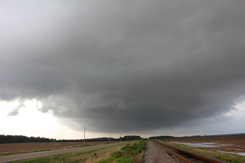
 Large rotating wallcloud north of Wynne |
 Large rotating wallcloud north of Wynne (closeup) |
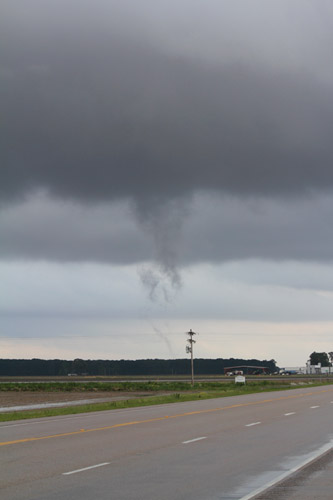
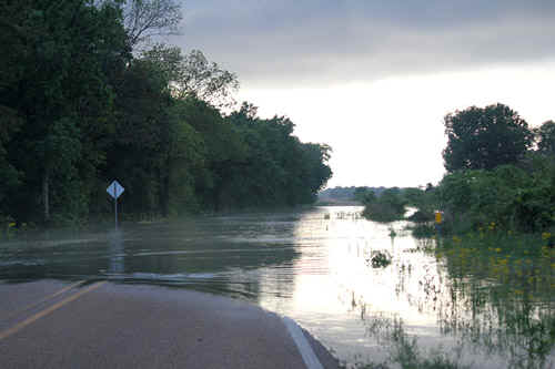 Flooded roads north of Wynne Flooded roads north of Wynne |
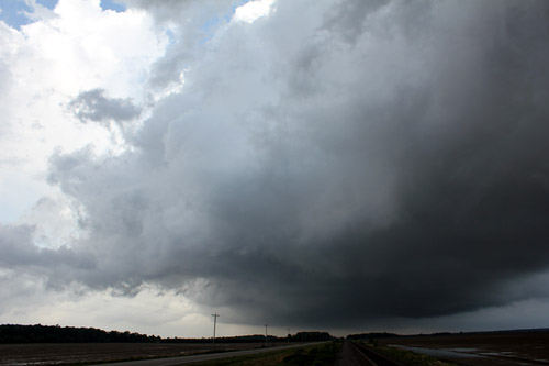
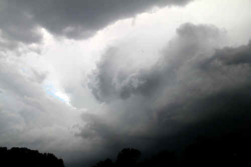 Rapidly rotating updraft near Little Rock, Arkansas |
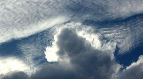 Complex shadow patterns caused by a penetrating Cb tower |
 Complex shadow patterns caused by a penetrating Cb tower |
| Stay tuned for tomorrow's episode... | |