| Day
12: 3rd May, 2010: After overnighting at Litchfield at a pleasant Days Inn ($84
including breakfast), I opened the west window of the hotel room and I'm confronted by a
reasonable looking guster (thunderstorm gustfront) - an area of overnight storms had
developed near St Louis and moved northeast generating a reasonable looking outflow
boundary and passed directly over Litchfield. With the shape of an arcus, it looked quite
threatening in the early morning sun. The storm area that had generated the outflow
gustfront had just about died out, leaving its outflow boundary wandering east for the
next couple of hours by itself. We're soon on our way and decide to take backroads towards the east and follow the boundary through very pleasant southern Illinios farm country. In some ways it appears as the heartland of the USA. There are vast areas of farmland across Illinios - the main crop appears to be corn, unlike Australia where you can travel across 2/3 of the country and see nothing but saltbush and scrub and a few eucalypts, most of the USA appears to be under agricultural development. You can travel thousands of miles and never leave farm and ranch country. Most of it is very neat and tidy with red barns and white houses. There is a surprising amount of wildlife, mainly squirrels, birds, armadillos, coyotes, raccoons and as we pass into a small settlement of Nokomis, we are stunned to see in parkland on the edge of town, 2 adult foxes and 8 cubs merrily playing in the park. We continue northeast through great viewing open areas - we forget as we pass through this green, fertile country, we forget that winters are harsh with temperatures falling frequently to near -20C (-5F), and yet summers can be hot and humid. We continue northeast towards Matoon, south of Urbana, where we park and wait for convection to start. As a weak cold front moves into western Illinios, it has become slow moving and is distorted by wave lows passing northeast from Texas and Kansas. Such distortions of cold fronts through the mid west are relatively common, and they can create localities of enhanced thunderstorm activity. We watch a line of convection to our west gradually building and after 2pm, a few towers suddenly rise and glaciate...and within 15 minutes we watch a stronger tower develop and then it all starts.....the structure of the line is changed into a linear arrangement of storm cells extending northeast along the cold front.. Several of the cells become dominant and start poking inflow tails southeast. The anvils are being sheared away very quickly and we deduce that the 500 - 300hPa flow pattern is very fast. Some of the updrafts are struggling against the shear (speed). We drive around in circles and squares for the next 3 hours photographing some very handsome storm structure with plenty of lightning and great looking rainshafts. As we get closer to 5pm, the storms start to die....we have a commitment in Montana and we break off the chase and head west..... |
|
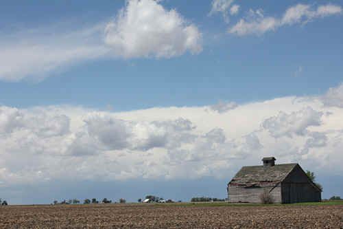
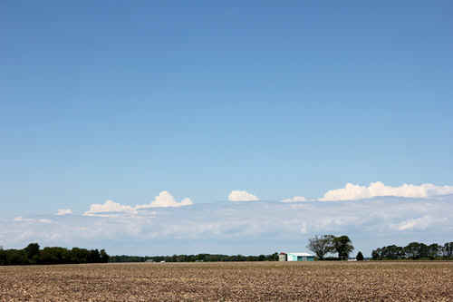
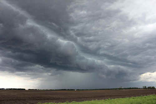
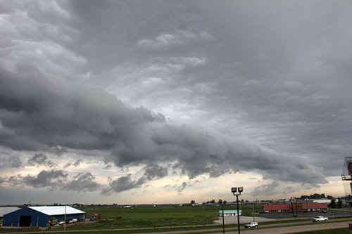 Early morning gust front, Litchfierld, Illinois -a pleasant breakfast view |
 Yours truly distracted by a music shop (the big window advertisement stated that they sold Fender....but I was puzzled by the shop owner who told me they didn't deal in Fender....so much for country music stores!) |
 Distractions continue....we come across a pack of 8 fox kits playing in a park at Nokomis, central Illinois |
 It appears that the foxes are tolerated as they live near a massive grain storage area - undoubtedly they feast on mice and rats. |
 |
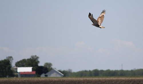 We are surpirsed by the amount of wildlife living in central Illinois....this magnificent eagle landed near our location.
|
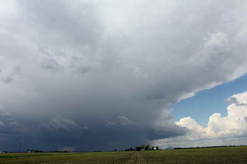
 From clear blue sky to a line of cumulus, marks a slowly advancing cold front, central Illinois |
Within an hour the line of cumulus had eveolved into a linear storm complex (diurnal forcing) |
 |
A small but potent updraft rides an outflow nose of a collapsing multicell |
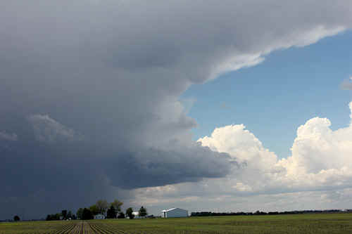 |
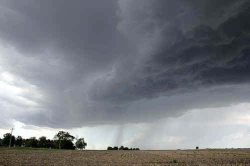
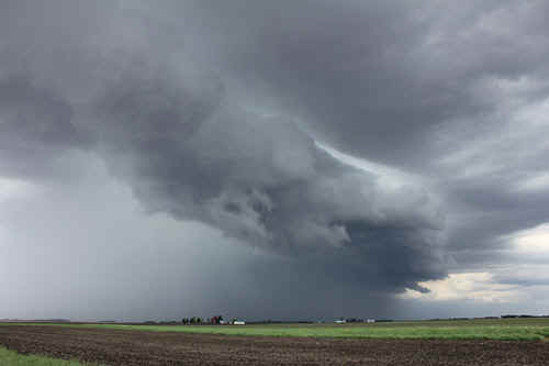
Tail end Charlie structure SW of Champaign, eastern Illinois |
 Tail end Charlie structure SW of Champaign, eastern Illinois |
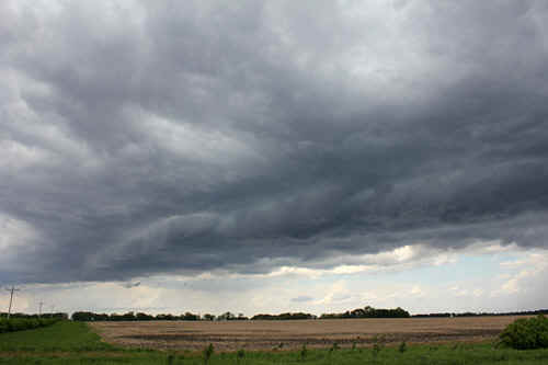
 Broad flanking line of the tail end Charlie storm, SW of Champaign |
 A new tail end Charlie matures right at the SW tip of the line |
 This storm became briefly severe with hail and lots of lightning |
|
The far SW tip of the line showed strong convergence.
|
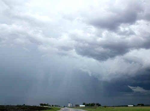
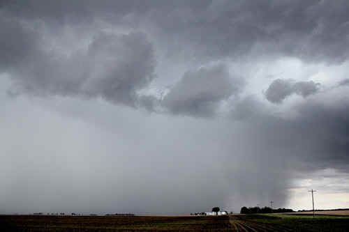 As the tail end Charlie storm matured it released a mammoth downpour! |
|
Hail streaks are visible at laster stages, however the storm is now dying and becoming outflow dominated |
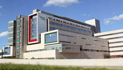
Stunningly large children's hospital, Peoria |
|
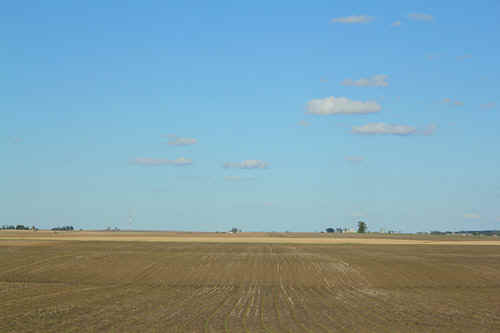
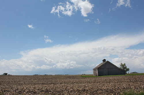
Flat western Illinois farm country |
|
| Stay tuned for tomorrow's episode... | |