| Day 20: 11th May, 2010: The Woodward LP Supercell We overnight at Independence at a traditional style old motel with front of car nose to door...the rooms were smaller but ok...we weren't too worried anyway after our mad chase of 400 miles...the short, stubby motel manager looked shifty...but not as shifty as the miserable breakfast he turned out the following morning! which consisted of a few wrinkled donuts and cold coffee...we were prepared for these occasions - we carry a loaf of bread, jam, butter, and our own drinks in a cooler - that setup comes in mighty handy at times! Our plan today is to head into NW Oklahoma...where a weakish dryline and surface low pressure lingers. The region around Independence is undulating with trees interspersed with wooded hills. The road winds around through small villages - the sort of stuff you see in small town America. We continue west across I-35 onto the plains of central Kansas - from there into central north Oklahoma and west into Woodward. We do the internet cafe thing at McDonalds at Woodward and meet up with a Colorado chaser, a friendly fellow who obviously does the miles for the smiles. He was pretty sure that Woodward would turn it on for the evening, but relatively dry air is still present over northwest Oklahoma. Ahead of the dryline, now along the Texas-Oklahoma border, a warm front is advancing north from Texas into western Oklahoma and dragging a pretty good stream of moist Gulf air with it. Being somewhat impatient, we decide to dribble south to look for better moisture. After an hour or so we see a reasonable looking multicell to the south after we arrive at Harmon. With nothing else in the entire state of Oklahoma we decide to go for a look and end up at Elk City. For a while, this storm looked ok with some reasonable pulses, however, it was a shy storm that immediately collapsed as we arrived. Somewhat bewildered considering temperatures were into the mid 80's and humidity was near 70%, and a strong southerly had set in behind the warm front, we looked around for a reason as to why this cell had collapsed. There was virtually a ring of clear air around the orphan anvil. We spot an outflow boundary dribble north across I-40 which was throwing off pathetic looking turkey anvils, which rapidly detached from their updrafts leaving behind a mare's tail looking precipitation trail. We follow the boundary further north to Cheyenne country, and hesitate, deciding whether or not to head north or call it quits. This region of Oklahoma (western) is undulating but with good views. We notice a couple of the cells are now larger to our north and northwest, it;'s very hazy and difficult to define structure. It's also getting late and the sun is starting to lower. As the sun drops towards the horizon we start to see the outline of some spectacular anvils. The cell closer to us develops inflow bands but the cell further away to the NNW has a significant backshearing anvil - it's illuminated by the setting sun and looks spectacular! We decide to pursue! We connect onto Hwy34N and head back towards Woodward. The cell to the NW has now started to exhibit supercell structure on radar, but light is fading and we can't visually pick the storm out of the gloom and the haze. As we approach Vici, we turn west on Hwy 60 to Harmon, and for the first time, we view this amazing LP style structure of this supercell. It has a strong barber pole appearance with the updraft punching through a high round anvil. Lightning sparks form the top of the updraft column to the underside of the anvil. This is something that we haven't seen before....this dominator LP controls its environment as it spins north along the dryline. We spot a couple of weak funnels and photograph the updraft column as the sun finally gives up the light. We drive north from Harmon following the storm north towards Woodward - it has a gradually narrowing updraft column as it moves into progressively drier air with the infeed scavenging for moisture. Pretty soon, it's too dark and we give up the chase...we head east along a county road and back to our base at Watonga.
|
|
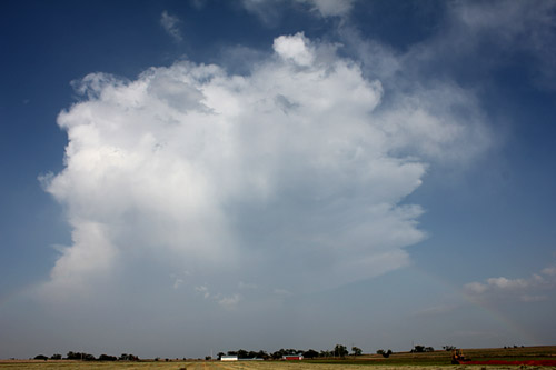
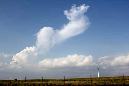
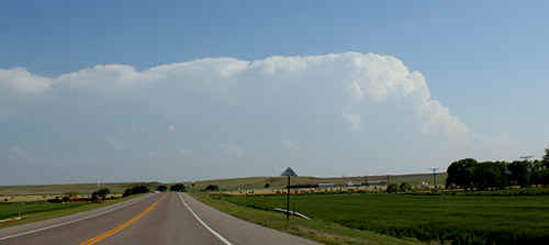 Mid afternoon Elk City mulitcell - only storm in Oklahoma at this stage |
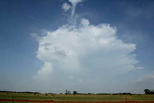
Orphan anvil streaming off to the east, Elk City. This storm fizzled in near record time of 5 minutes! |
|
A run out of puff cell near Elk City - this was the final stages of convection - even the tail was glaciating |
 The remnants of the Elk City cell drifted east and dissipated. |
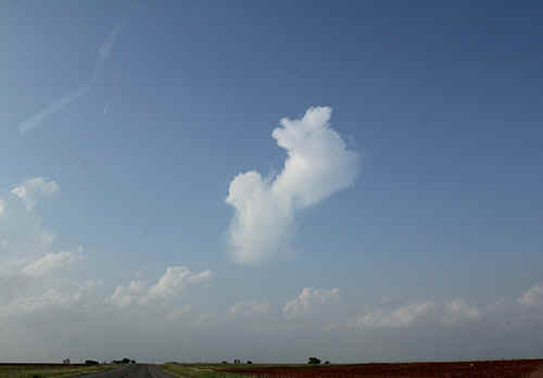 An orphaned rising thermal glaciates north of Elk City |
 Upper shear was not very strong and the glaciated turkeys hung about like deflated parachutes |
|
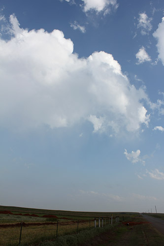
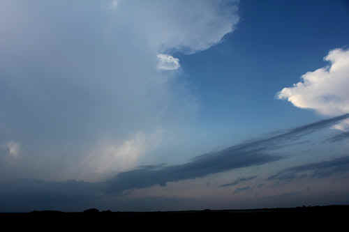
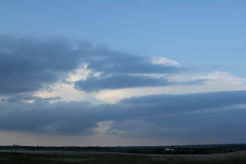
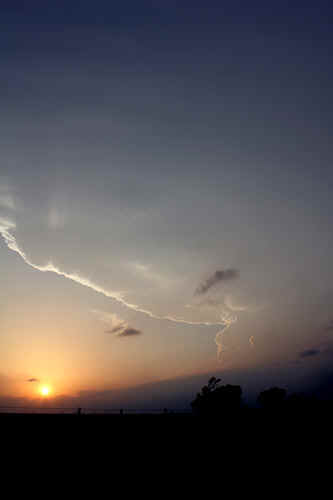
We followed a boundary northwards, possibly enhanced by the dissipating cell near Elk City. Early evening larger cells were developing further northwest from our location |
Rabbit ear anvil, vicinity of Strong City, western OK |
|
A closer cell was developing inflow streamers even though it was weak |
 Storm inflow bands near Butler |
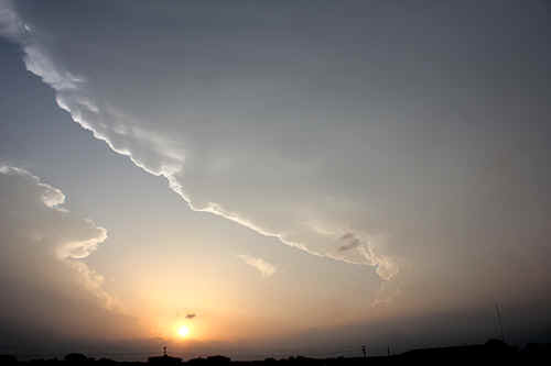
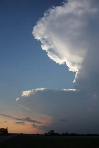
 The setting sun and anvil structure was absolutely brilliant to watch. The eventual Woodward supercell is in the background. |
 |
 Chasers' dreamscape |
Magnificent spreading anvil of the Woodward supercell near Leedy, Hwy 34 |
 |
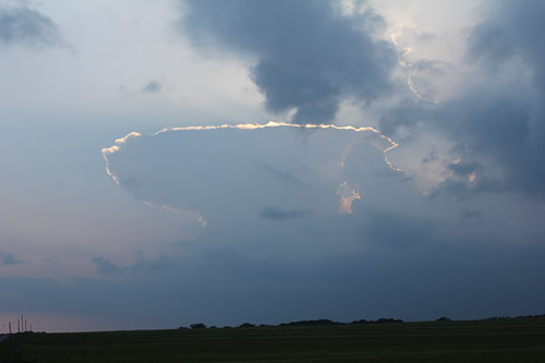
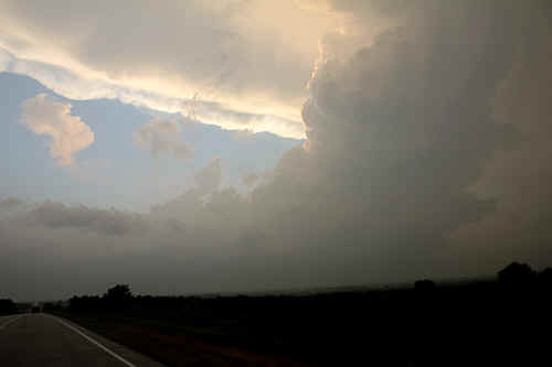
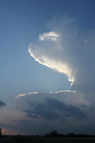
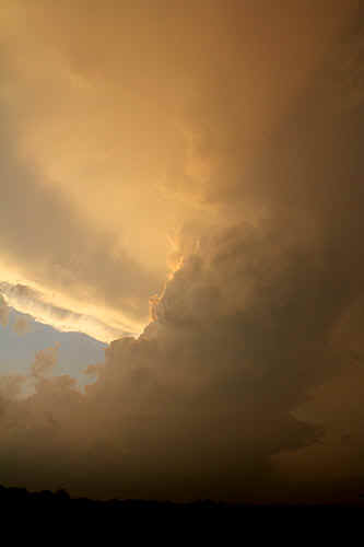
A classic shape of what appears to be an LP supercell (Barbers Pole) holding a sombrero on its head (anvil)..and inflow tail. |
|
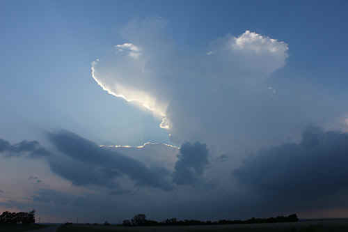
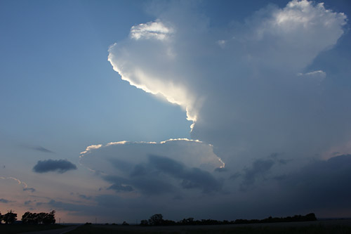
Chasers' dream! NE of Harmon |
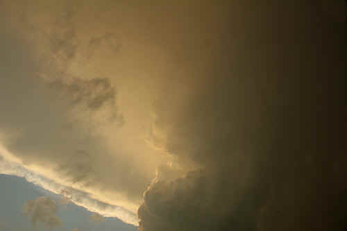
 Breathtaking imagery of the narrowing updraft column, NE of Harmon |
|
Near Harmon - structure of the entry point of the updraft core to the anvil. The entire column was rotating |
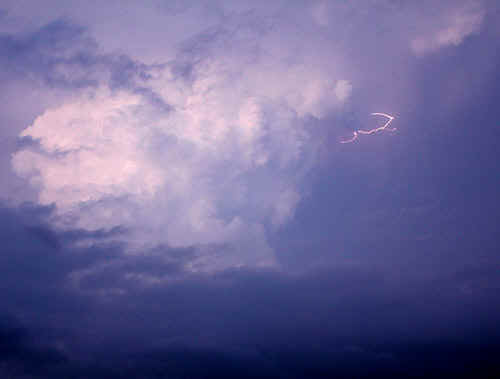
In true supercell fashion, lightning was bolting along from the top of the updraft column into the anvil every 2-3 seconds. SE of Woodward |
| Stay tuned for tomorrow's episode... | |