| Day
23: 14th May: Ennis - Odessa - Ozona, Texas: The area around Dallas - Fort
Worth is a quagmire of traffic. We skirted around the eastern side of DFW the previous day
and ended up at Ennis to the south of the Metroplex. Dallas-Fort Worth is surrounded by
lots of small and medium towns, all of them little metropolises in their own sense. The
region is plainly very busy and not good chase country. Our target today is west Texas...a quasi-stationary cold front extends from near DFW towards Odessa. This typifies the synoptic pattern at this time of year in central and lower Texas. Stalling frontal systems are a source of convergence and instability, especially when middle and upper level short waves and cold pools are advected from the Rockies across the stalling front. Overnight, a large MCS had evolved over south Texas, some localities recorded between 4 and 8" of rain from this quasi-stationary system. Along the stalled cold front. mid level storms were persisting. Our reason for targeting Odessa was that this was where the cold front more or less aligned along the dryline. South of Odessa are the Glass Mountains, a complex terrain of peaks reaching almost 8,000' - a region known as the Big Bend State Park. This is often a source of initiated early convection - as these high based storms drift onto the elevated plains around Odessa they can occasionally transform to severe categories. As we dribble east from Ennis on Hwy 67, we start entering a band of mid level showers and storms near Stephenville. They are totally unphotogenic! Under the mid level storms, is a deck of low stratiform cloud almost hugging the ground. The only indication apart from our radar was the gradual darkening of the environs and the appearance of big 'cat's paw' raindrops on the windshield followed by a torrential downpour. We eventually make it to the I-20 and point SW, cranking the Dodge Charger to maximum road speed. We are consistently delayed by heavy bursts of rain, occasional lightning and poor visibility. Several hours pass and we approach the Midland-Odessa region. Already, deep convection has started along the front/dryline, but it's difficult make head or tail out of anything as we are enveloped in a thick mist from time to time. We are riding along the north side of the cold front, the cooled air (near 60F/16C) is saturated. This is the worst kind of chase conditions...fog, rain and limited visibility not to mention the bunched up traffic and semi trailers. We make it through Midland and conditions improve visually. We drive to the western side of Odessa - radar returns are showing rapidly intensifying cells in our region. They are drawing their energy from the south side of the cold front where temperatures are near 20F warmer. They ride up along the frontal wedge and rapidly expand into large supercells. We drive northwest on Hwy 302 towards Kermit - it's now clear enough to see base features. We spot a wedgy type of wallcloud to our SW although visibility is rather poor. We drive about 10 miles towards Kermit and pull over to photograph and video. Just down the road, are the weather circus fraternity - Vortex2, the TIV and hordes of chasers and television stations. The wall cloud takes shape and rotates....but these storms are acting a little odd - we suspect that upper level speed shear is rather weak, and the first supercell we photograph is rapidly outflow dominated. We drop south along Hwy181 towards Penwell, and photograph the decaying wallcloud and brief funnels generated along the outflow boundary. The storm cores are moving NNE and they become elevated vigorous multicells as they drift northward. Another cell is developing to our southwest, and has a curious detached wallcloud on its southeast quarter. We take up position near Penwell as this storm rapidly transforms to a large supercell. We watch a low level inflow jet cannon into the wallcloud from the NE. The rope appearance aligns along the raincore outflow - but there's more to this than meets the eye....we watch the outflow alignment of this rope literally bend into the wallcloud and punch through to the other side, deforming the wall area. We have never, ever seen anything like this (refer to photograph). The appearance of the wall area has become so distorted that it takes on multiple shapes as it battles with outflow - as in the previous supercell, outflow dominates and a soon a nose of cooled outflow destroys the wallcloud and speeds towards the south. Eventually an arcing gustfront appears, moving SSE, digging into the warm air, generating boundary rotation and gustnadoes. We follow the outflow south to Crane on Hwy 385. Crane is an oil town between Odessa and McCamey, but we can hardly make it out as it's blasted in a duststorm. Large palls of dust rotate into the outflow boundary. We drive east of Crane for a short time watching more gustnadoes. Many areas around Odessa, Midland and east of Crane experience heavy rain and large hail as the second supercell dissipates. We wander back west towards Grand Falls on Hwy 329 where we notice high based cells are very lightning active. We arrive just as one major cell dissipates, but we notice a bell shaped lowering to the SE of the dying cell. We follow....for the next 2 hours we follow stupendous storm regeneration with fantastic lightning, astonishing structure and a flanking line to die for!! This supercell has attained a steady state, although it appears complex at times, it has managed to get its tail clear of outflow and draws on Gulf air southeast of its centre. Near Iraan, we pull over to watch the most fantastic lightning show we have ever seen. Every 2 or 3 seconds a ground stroke cracks around us, and then in a finale, the storm generates an unbelievable structure as light fades, sparking lightning from its wallcloud and glowing blue from almost continuous internal lightning.....completely exhausted, we overnight at Ozona near I-10. We've taken hours of video and snapped no less than 1300 images. |
|
|
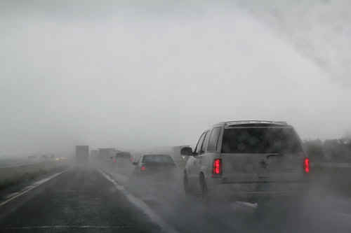
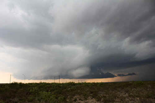
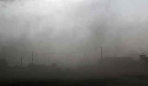
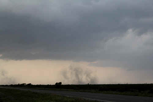
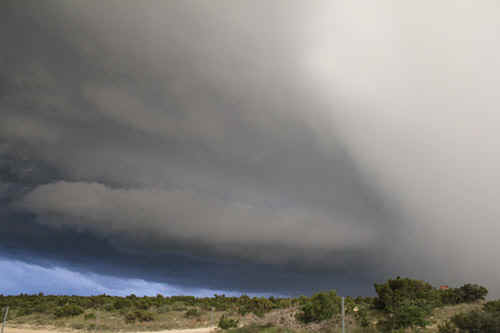
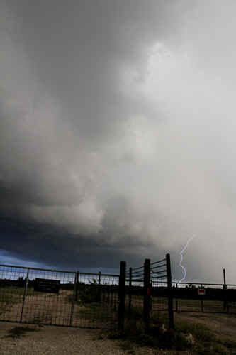
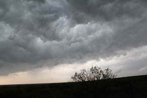
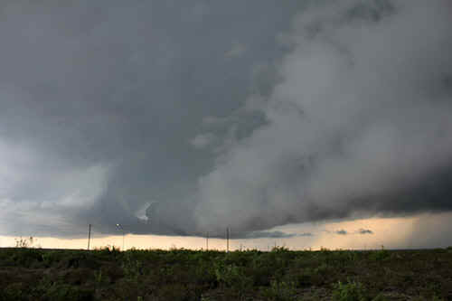
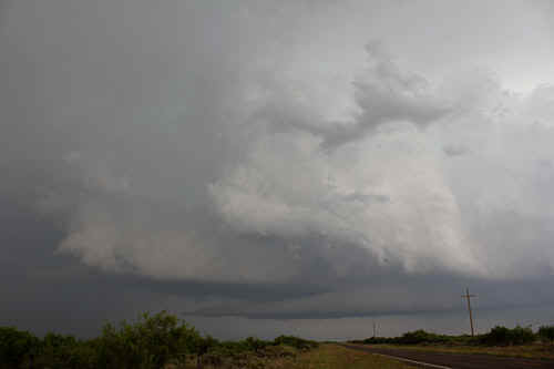
Horrendous driving and poor viewing approaching Midland / Odessa. The storm above us hidden in the mist was tornado warned. |
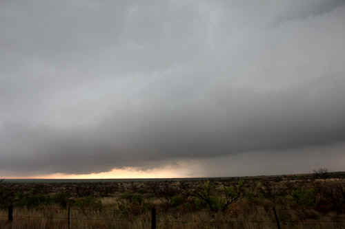
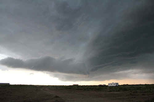
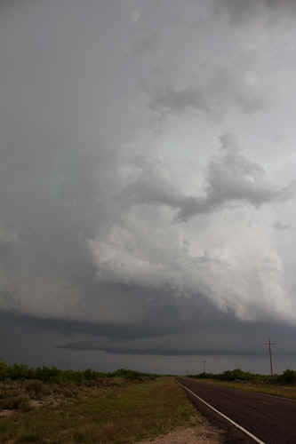
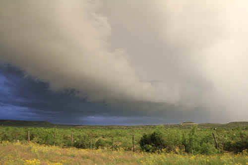
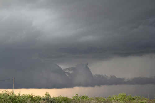
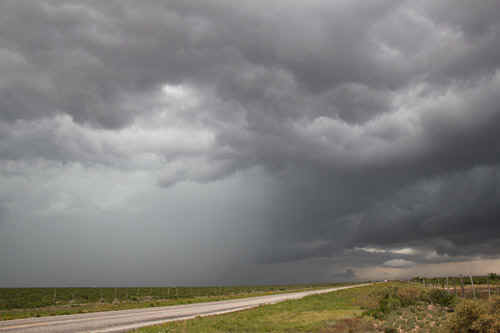
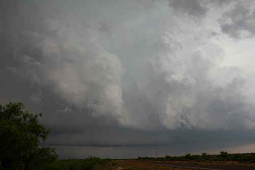
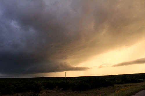
First supercell of the day near Odessa |
|
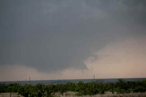
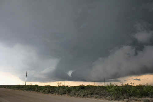
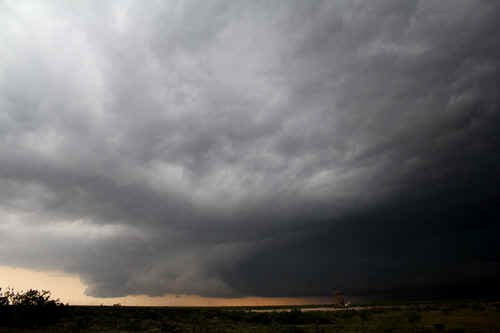
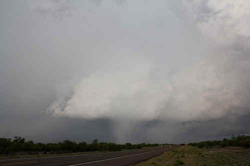
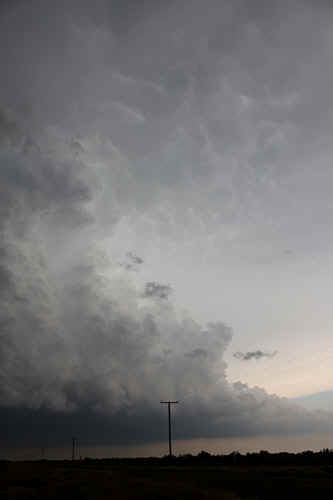
Rotating wallcloud west of Odessa.
|
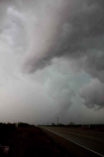
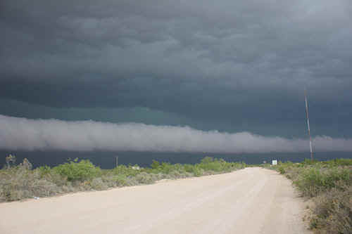
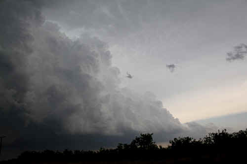
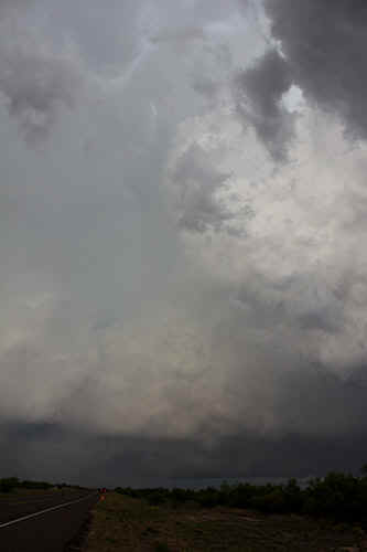
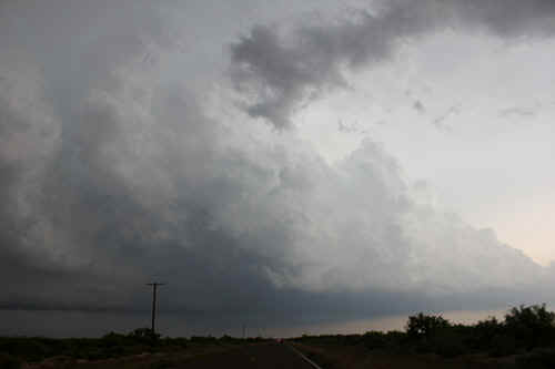
 The Yanks call this the 'whales' mouth' where the storm outflow underruns the flanking line - the storms become outflow dominant pretty quickly after this stage. |
|
Yikes!!!!! A rotating funnel appears near the RFD of the Odessa supercell (shortlived) |
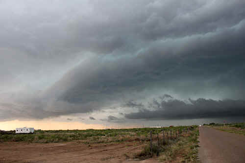
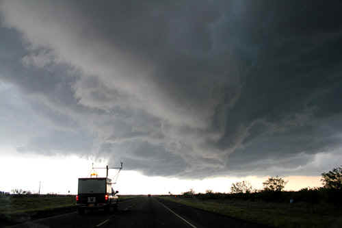
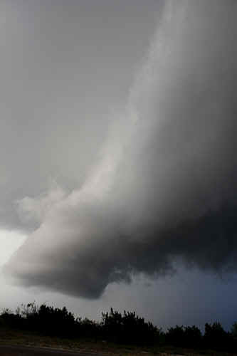
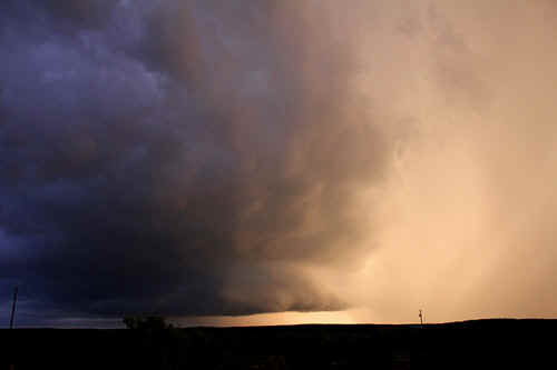
 The second supercell had a detached meso located several miles from the rain core, W of Penwell |
|
The second supercell developed rapidly with the meso working in closer to the raincore. This is the rotating wallcloud located near Penwell and was quickly overrun by outflow. |
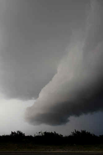
 Structure of wallcloud, near Penwell |
|
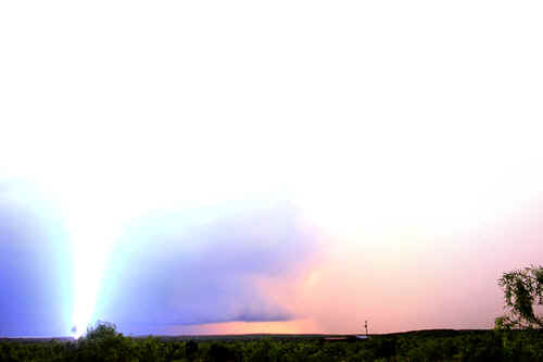
North of the wallcloud a magnificent rollcloud appeared. The rollcloud initially we thought was outflow along the rain, but then we noticed the rollcloud jetting into the vicinity of the wallcloud and punching through the meso...we then deduced it was an inflow jet on the cool side of the supercell (SE side) |
Low level rollcloud speeding from the NE punching into the wallcloud, Penwell |
 The
SE quadrant inflow jet to the wallcloud was really rocketing along from right to left The
SE quadrant inflow jet to the wallcloud was really rocketing along from right to left |
 |
|
Outflow destroying the wallcloud south of Penwell |
Southeast of Penwell, the wallcloud is being undercut by the storms outflow but still makes for interesting photography |
|
Outflow overruning wallcloud near Penwell |
Vortex 2 research vehicle drives along the outflow boundary north of Crane |
|
50 knot+ gusts accompanied the outflow boundary through Crane with lots of gustnadoey things! |
Gustnadoes on the outflow near Crane |
 Decaying supercell east of Crane |
Developing supercell SE of Grand Falls |
|
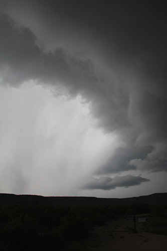
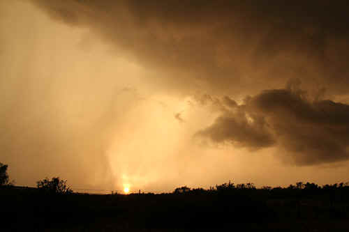
Hailshaft falling through a decaying updraft core, near McCamey
Supercell flanking line near McCamey |
 The 3rd supercell of the day got itself going around Grand Falls and we followed it SE for 2 hours |
 |
 |
 Complex structure near the main updraft core, west of McCamey |
 Flanking line west of McCamey |
|
|
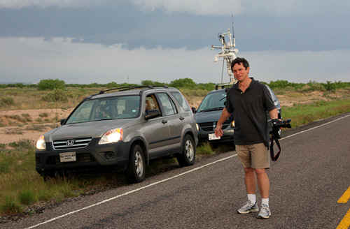 Dr Harald Richter, Australian Bureau of Meteorology, Melbourne - we found him running around in circles under a meso. |
The storm we followed from Grand Falls passed near McCamey. We suspect the storm achieved its strongest phase in this region |
|
Wallcloud south of McCamey and main updraft core. |
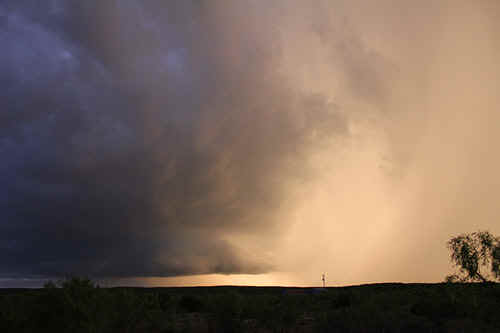
This area of the storm became the focus for inflow and eventual wallcloud development, Iraan |
|
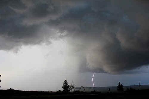
Near Iraan, the 3rd supercell produces tremendous hailshafts and bulkloads of lightning. It was a flangfest! |
Hailshaft and lightning bolt near Iraan |
|
There was so much lightning associated with this supercell you could literally point a camera and catch one - so we did |
A startling pedestal lowering west of Iraan |
|
The pedestal lowering rotated slowly |
 Storm structure between Iraan and Ozona, very late evening |
 A beast of a bolt lands only 50 metres away! We feel the heat and the shockwave. The lightning flash overwhelms the camera and I don't recall pressing the shutter. |
SE of Iraan, this storm displayed magnificent structure as it pushed its wallcloud clear of its rainshaft. |
 We were stunned by the internal blue phosperous glow caused by continuous internal lightning |
 Setting sun shines throgh trailing precipitation east of Iraan |
| Stay tuned for tomorrow's episode... | |