| Day
25: 15th May: Texas: After the excitement of the triple supercells on the
previous day, the prognosis today shows a stalling front near the Mexican - Texas border.
We are in a region of Texas known as the Big Bend...and it's relatively elevated. Fort
Stockton is 2,600' above sea level, but to the south rise the Glass Mountains, exceeding
6,000' feet in places. The Chisos Mountains are even higher reaching almost 8,000'. They
are located on the Mexican border. This area can often be a source for enhanced
convection. Once established storms can drift off the mountains onto the hot flat plains
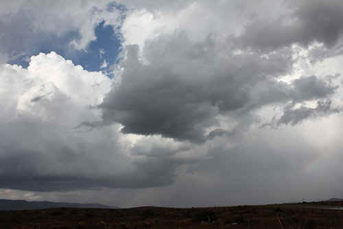
to the north, and if there's enough moisture, they can become supercells. A lot of good plans become unstuck in regards to weather, and today, the near stationary front had shifted further south than expected. This was caused by large scale outflow from the previous day's supercell activity. We were having some trouble with our wireless connection, and we make for the nearest McDonalds to make use of their WiFi facility. As we walk in the door, we instantly recognise a couple of colleagues from Australia, although to put that in perspective, 2 New Zealanders, 1 expat New Zealander living in Darwin and Dean Narramore from Mildura in Victoria. Dean is a bright fellow who has just graduated in atmospheric sciences and is an avid storm chaser. It has become obvious that you will find Australian / New Zealand weather enthusiasts either under a supercell or in a McDonalds in the USA! We have a very enjoyable hour or so chatting about some of the prize storms we have scored. While all the socialising was going on, we were also keeping an eye on radar for the first convective reflection. By mid afternoon the first radar reflectivity appeared around Glass Mountains to the south. It's relatively weak but it's better than nothing. We shake hands, pass pleasantries, such as "see you under a storm, guys!", and we drive south. We drive south on Hwy 67 towards Alpine - the flat
country around Fort Stockton and to the south could be regarded as semi arid. The region
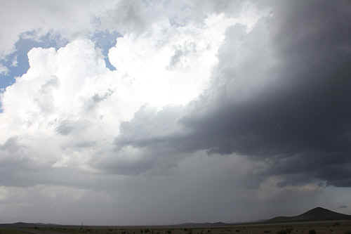
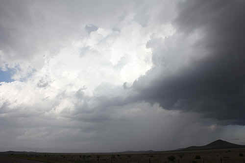
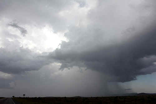
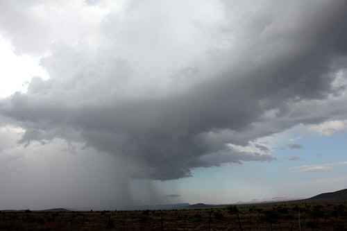
barely scrapes in with 12" Instead of driving to Alpine, we turn left and head for Marathon. This small town is located on the south side of the Glass Mountains at an altitude of over 4,000'. A short main street is obviously designed to cater for tourists. We walk into a gallery and notice a 20" x 10" photograph of a mountain selling for $2000 USD!!!!! We pass on the gallery and head for a bookshop...where us big spending Aussies spend $20 on a geology book. Meanwhile, the cumulus are rebuilding to our south....and we drive out of town and head north on Hwy 385 where we find already a storm brewing about 10 miles north of Marathon. Although these storms never achieve anything other than a weak status, they provide us with an opportunity to photograph the Glass Mountains in a stormy environment. We drive in and out of rainshafts replenishing this arid country. We would recommend anyone travelling to Texas to spend time in the Big Bend region, especially in the high mountains. We head back to Fort Stockton, and that evening we watch a supercell grow in no-man's land well to our southeast over Mexico. |
|
 |
 |
 |
 |
 |
 |
| Stay tuned for tomorrow's episode... | |