| Day
25: 16th May: Fort Stockton - Shamrock, Texas: We leave Fort Stockton in a clammy fog. Our destination today is north Texas, or thereabouts....a boundary is moving in from Kansas that we hope to intercept later in the afternoon somewhere south of Shamrock. We cut across country to I-20, passing through farm and ranch country with a mix of oilfields. An MCS had been moving slowly SE overnight towards the far southeast of Texas, leaving behind a relatively cool and very humid surface airmass. We pull over for a break in Colorado City...and we spot a western clothing company. The business is run by a part American Indian - part Mexican gentleman dealing in boots, belts and ladies formal wear. I'm startled when he tries to show me the ladies formalwear! then noticing that I wasn't too keen offered me a bright orange shirt for $30. It looks somewhat odd, being of Mexican origin, dressed up in Texas boots and a Texas hat, and a tight Texas belt..the problem was, he was only 5' tall and I couldn't imagine him jumping onto an 18 hand horse. But never mind, I finally let him know that I was here to buy some belts. At most places I had been looking, the famous Texas buckle belts were made in China or Taiwan. Instead I settled for 3 good quality Mexican belts at $15 each. With the shopping aside, we are keen to continue our journey north and by mid afternoon, we are approaching Childress on Hwy 83 where we see our first outline of a mature cumulonimbus to the north. Radar shows a reasonable cell west of Shamrock, and we hotfoot it in pursuit. By the time we approach Wellington the alignment of storms has weakened to our north, although the tail end Charlie still shows a reasonable flanking line. We arrive in Shamrock just as the storm passes east so we pursue on I-40. We follow the storm for about 20 miles before we give up the chase as the storm dissolves into an orphan anvil. The satellite imagery shows a distorted boundary line in the vicinity of Shamrock and extending southwest. Subtle boundary lines are often a source of rapid storm generation in the evenings across this part of the world especially if moisture is available, as it is today. Shamrock is a small town with reasonable facilities just west of the Oklahoma border. We have stayed there before and enjoyed the locality. We book into a hotel and then wander out to buy tea. Instantly we are taken by an alignment of rapidly growing cumulus to our south. It's early evening and the plains have done their trick - the alignment grows rapidly and soon the storms are maturing about 20 miles to our south. We forget about tea.... We are soon driving through the main street of Shamrock with the brilliant structure of a rapidly growing storm line to the south. We drive to just north of Wellington and drive west to Hedley where we plonk alongside a great vista to our west across farm country. A large cell is maturing to our southwest and is very lightning active. We note a rather small cell located further west along the line which appears to be moving slightly to the left of our location - it has a persistent flanking line and eventually becomes the dominant cell as it approaches us. It develops interesting lowerings on its outflow southern side, simultaneously, the flanking line forms a rather weak wallcloud feature. We decide to drive further west. The Hedley cell is looking better all the time! and soon our weather radio squawks - the Hedley storm is now severe warned and the region has been put on a tornado watch. We drive west closer to Hedley and pass under a rather small wallcloud. We drive into bright sunshine and an eerie yellowy surface glow which is reflection from the main updraft on the western side of the storm. We stop and look east at an absolutely magnificent almost vertical updraft emanating from a short flanking line. Over the next hour we watch this storm approach supercell status - it develops rotating lowerings on its flanking line, but the main thrill of seeing this storm was the change in colours of its western side as the sun sets. It was worth the drive! |
|
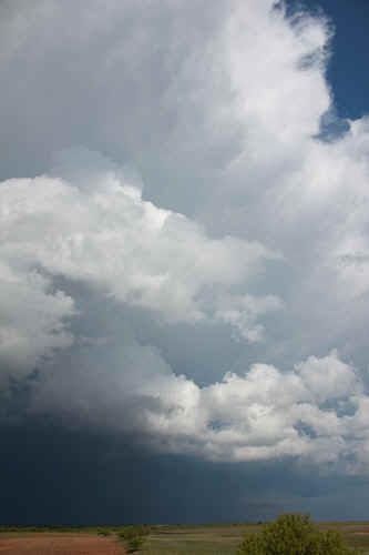
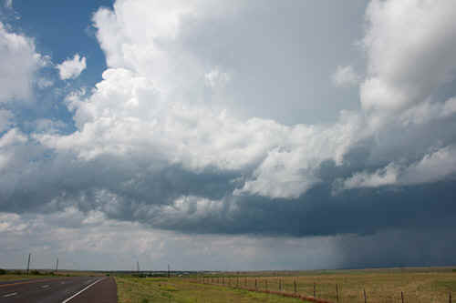
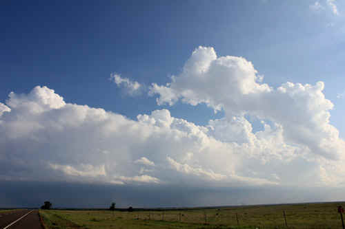
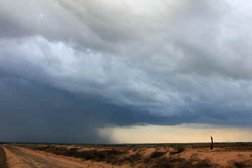
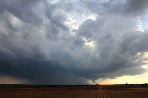
 Mid afternoon convection along a boundary west of Shamrock, TX
|
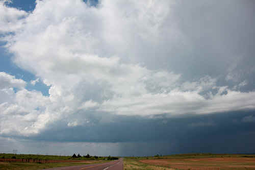
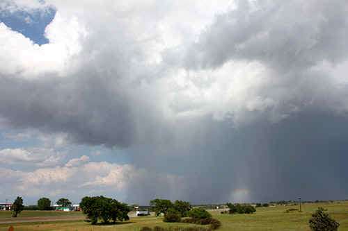
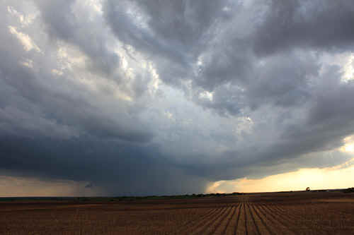
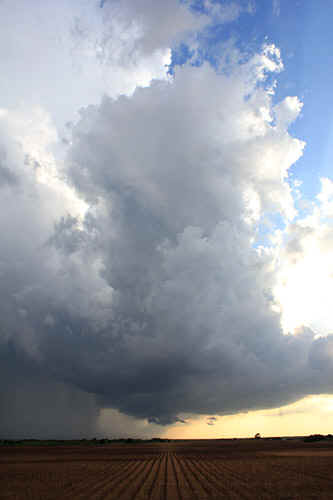
 These storms were severe warned from time to time, produced 2cm hail, strong winds. This image between Wellington and Shamrock. |
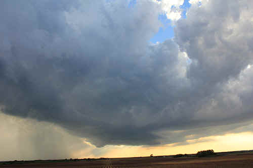
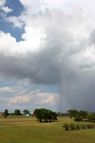
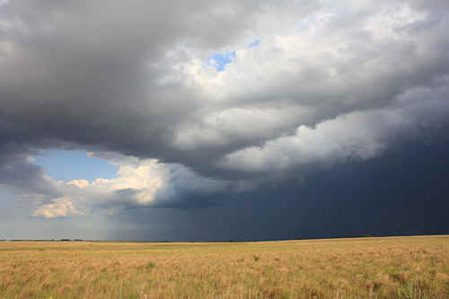
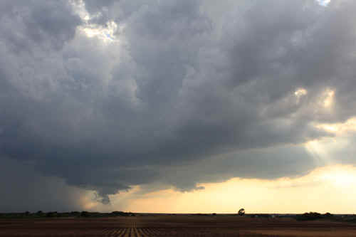
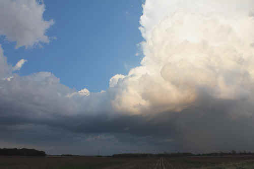
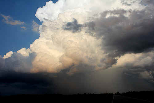
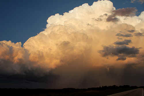
 The tail end Charlie storm passed directly over Shamrock. Mid afternoon storms struggled and dissipated by late afternoon. |
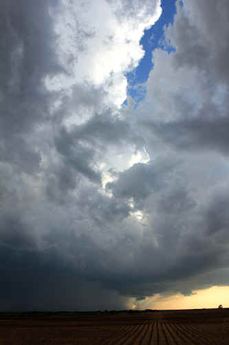
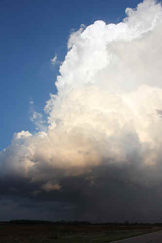
 For a time the Shamrock storm retained a weakish flanking line and rainfree base. |
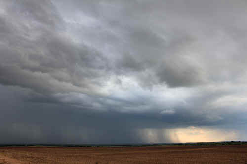
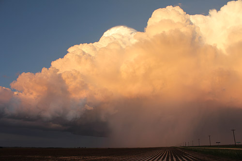
 The Shamrock storm weakens along the I-40. |
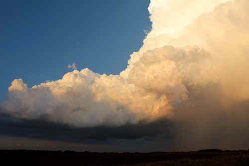
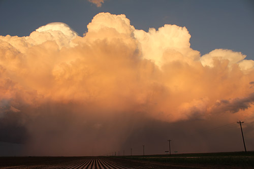
 The weakening Shamrock storm maintains a declining flanking line - I 40 |
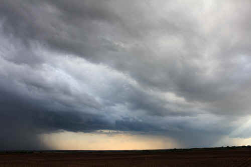
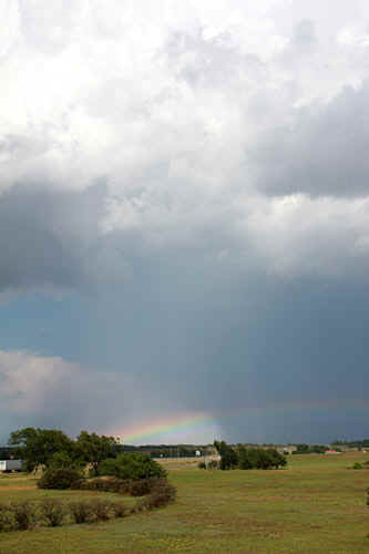 We photograph patchy rainbows...I-40 |
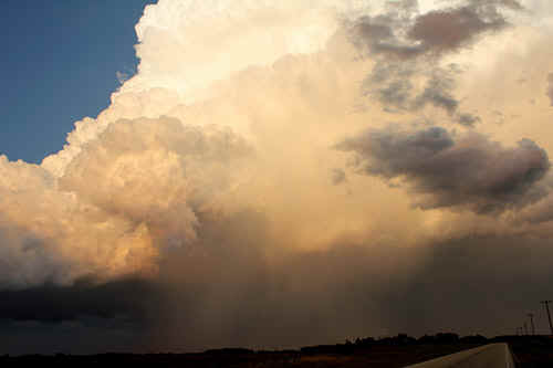
 Early evening convection tarts again along the original boundary south of Shamrock |
|
|
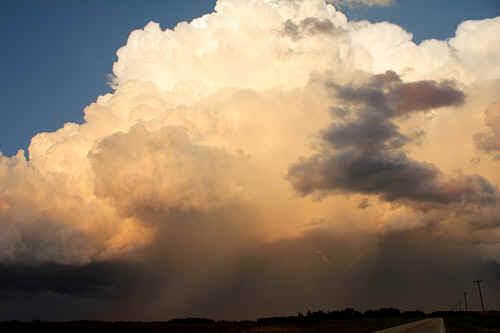
 New conve4ction near Wellington generated more pulses on its northern edge. |
 Potent cell west of Wellington |
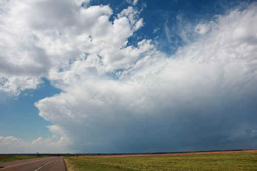
 In this image, 2 cells are apparent. The right cell eventually became the dominant storm. (west of Hedley) |
 We watch a strongly lightning active cell pass south of Hedley. |
 This was the tail end Charlie storm along the boundary, and was now developing pretty good inflow on its northern side.
|
 Initially the main updraft looked only moderately strong as it approached our location. |
 The tail end Charlie cell expanded fairly
rapidly, generating strong outflow on its south eastern side...... The tail end Charlie cell expanded fairly
rapidly, generating strong outflow on its south eastern side......
|
 Looking west towards the main updraft core, Hedley. |
 The strong rainfree base occasionally dropped lowerings. The storm was now producing almost continuous thunder. |
|
The Hedley cell struggles with outflow and temporarily becomes linear. |
 The Hedley storm cranks up with a stronger rear updraft. It also developed an inflow tail feeding in from the northeast. |
 |
 |
 |
 |
 |
 |
 |
 |
 |
 |
 |
 |
 |
 |
 |
 |
 |
 |
| Stay tuned for tomorrow's episode... | |