| Day
32: 23rd May: After an exhausting day in South Dakota on the 22nd May, we
overnighted at Aberdeen, the largest town in northern South Dakota. The remnants of the
previous day's tornadic outbreak had evolved into a linear storm complex, and passed
through Aberdeen about 9pm with hail, torrential rain and strobe lightning. The weather
conditions in America were testing our stamina, racking up huge mileages and interacting
with monster storms for more than 4 weeks, but we were awake by 6am. Our trip today would
take us south through South Dakota, Nebraska, Kansas and northeast Colorado. The prognosis
was for severe storms extending from Oklahoma to eastern Nebraska. The northwest of Kansas
was the pivot point for expectations of the best supercells. This was good, as it was on
our way back to Denver where we will terminate our chase season in the USA. We are soon
heading south on Hwy 281 which extends all the way into southern Nebraska. It's mainly a
straight road with a few doglegs. We pass through the rural landscape of South Dakota with fresh green crops already springing. South Dakota has fierce winters with temperatures falling well below 0F from time to time. The locals appear friendly and hardy. You meet them in gas stations where they often congregate for coffee and chats. We overhear them, relishing the great rains that have effected the Dakotas this spring. By midday we are travelling through Nebraska - Hwy 281 passes through again mainly rural countryside with a sprinkling of small towns. By mid afternoon we are into Kansas, and heading west towards our target area of Brewster. The dryline extends from SW Kansas to north central Kansas and is marked by a line of scrappy cumulus. Isolated storms have already broken out in southwest Kansas and are moving fairly rapidly northward. Temperatures are already in the low 90s F (32/33C) and dewpoints are in the mid 60's (18/19C). We finally reach our destination near Brewster and a large anvil is already overrunning the area from a complex but severe multicell to the south. The core of the storm is moving north at near 75kmh. We decide to run west ahead of the core along Hwy 18 to Colby, however we are overrun by a weakening storm, but it still manages to drop torrential rain and occasional golfball hail. We finally make it into clear again west of Colby, and watch an outflow boundary kick off more storms to our north. A major supercell has developed about 40 miles ot our south and is now tornado warned. We head further west to near Edson, but the edge of the supercell overruns us, and we seek cover under an old gas station canopy just east of Edson after we encounter golfball hail. We park under the canopy with several other chase vehicles, when we are enveloped in a swirling spray of rain and huge hailstones, - at least baseballs! There are very close lightning strikes and deafening booms! It's a weird vision we have with this storm...the sun is shining all the time and yet we are enveloped in a maelstrom...it lasts about 5 minutes and suddenly stops....the powerful lightning strikes the ground all around us, and occasionally a baseball hailstone will land making a huge BANG! on the canopy roof. Eventually we leave the vehicle to get a better view of the storms structure and a bunch of chasers are peeking out from under the canopy - we are directly under a beaver tail that is jetting into a wallcloud just ot our northwest - we see a funnel spin...and evaporate. The beaver tail appears stationary, but the cloud motion is rapid. A wall occasionally appears, eerily lit by the sun, then occasionally disappears behind its rain wrap. The core of the storm continues to move northward away from our location, and its size is increasing all the time. As light fades, the frequency of lightning appears to increase and soon the storm is strobing with the best of them! We follow the storm along I-70 where we see the wallcloud produce occasional spinups. Eventually we pull off the road in almost total darkness just west of Edson where we continue to photograph as best we can and video the astonishing lightning. A fresh wallcloud appears just ot our NW and produces twin rotating funnels which are easily seen in the back glow of lighting, but then we are stunned - when a huge elephant trunk tornado appears further to our north. This monster is illuminated almost continuously by lightning! We cannot chase any further - the road is dirt and we will not chase along dirt roads especially with the memory of South Dakota the previous day when 6 chase vehicles were trapped in mud with a huge wedge tornado bearing down on them. We watch this lightning lit tornado for 5 minutes before it recedes into its wallcloud and disappears - we can hear distant sirens screaming. This is how we end our chase - what a fitting finale! 27,000kms and untold number of storm adventures - we did the miles and got the smiles!
|
|
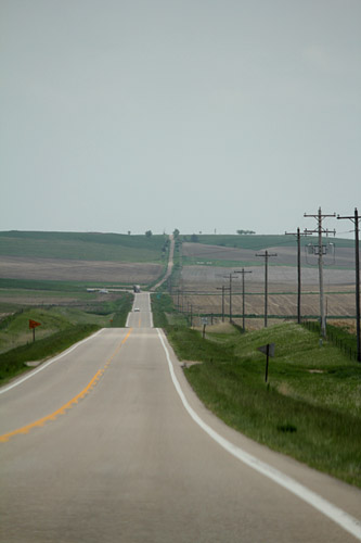 Another great storm road, this time in Nebraska, heading south. |
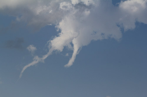
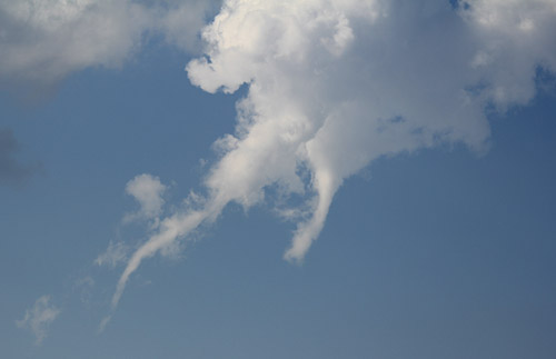 A cumulus turkey tower detaches from its base and develops twin rotating funnels - just about everything rotates in Kansas on a tornado day! |
|
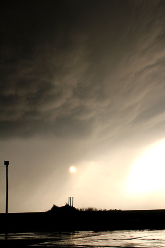
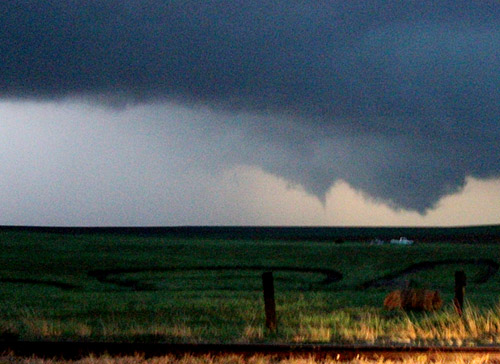
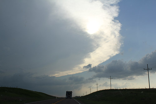 Rapidly spreading anvil near Brewster, Kansas |
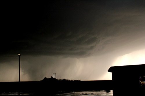
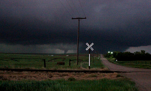
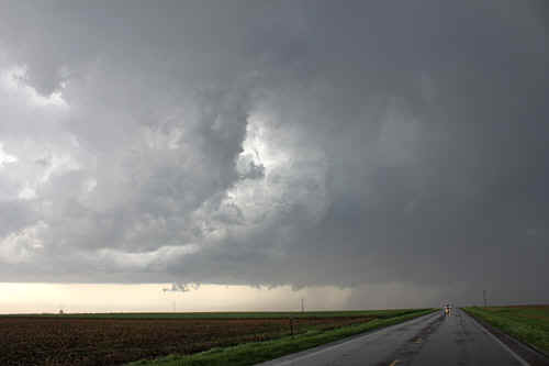 The first storm near Colby we encounter develops along an outflow, looking north |
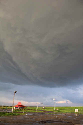 Under a beaver tail, near Edson, Kansas |
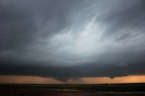
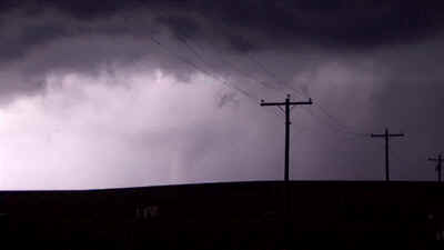
 A jaw dropping wallcloud near Edson |
 The wallcloud was wrapping just about everything into it |
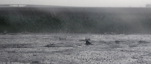 baseball hailstones splashing in flash floodwater, near Edson. We sheltered under a canopy of a disused gas station |
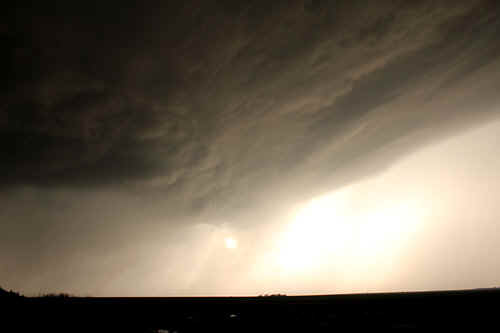
 The storm core recedes to the north and was growing all the time. |
 Apart form baseball hail, the storm was sparking huge bolts of lightning and deafening thunder. |
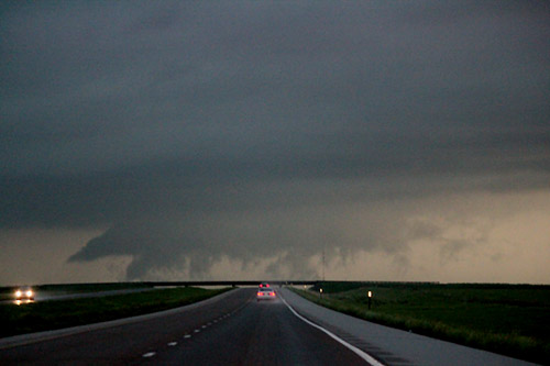
 We follow the wall beyond Edson, which was developing sporadic funnels and spinups |
 A large wall area develops multiple vortices west of Edson. |
 Twin funnels rotate near Edson |
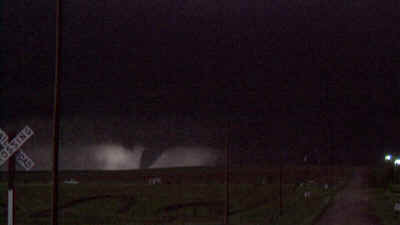
 Night time photograph of a tornado NW of Edson. We were not game to chase along a dirt road in the dark. |
 HD Video capture of the lightning lit tornado north of Edson
|
 The tornado was a huge elephant trunk and looked great backlit by lightning. (HDV capture) |
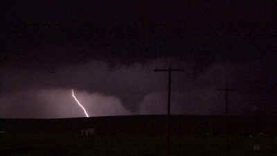 Lightning sparked every 2 -3 seconds in the vicinity of the tornado. (HDV capture) |
| Stay tuned for tomorrow's episode... | |