| 24th
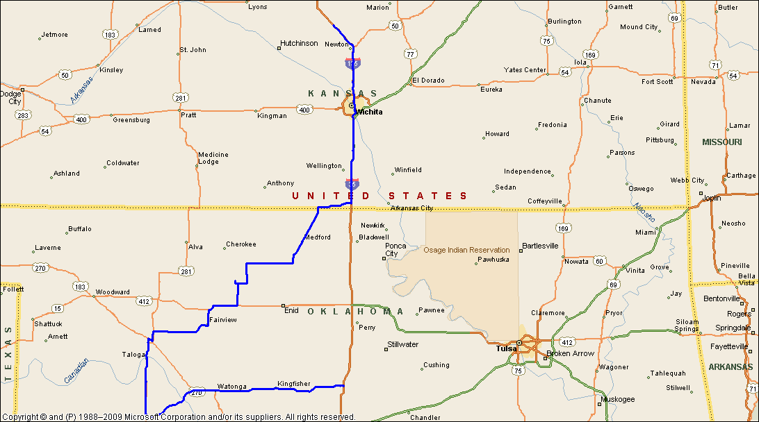
May: Guthrie, OK to McpHerson, KS. The Cedar Springs / Fairview tornado After our busy day on the 23rd after encountering a tornado at Fairview and a mega rotating wallcloud at Kingfisher, we were now on the go again heading west for the dryline draped across western Oklahoma. Today was predicted as a significant tornadic risk day for all of Oklahoma and southern Kansas. The southerly was pumping moisture into Tornado Alley, dewpoints were to remain in the low to mid 70's all day. A shortwave trough was expected to overcap the region by late afternoon, moving rapidly from the Rockies and bringing a vigorous midlevel jet in excess of 70knots. There were lots of chase groups at our hotel in Guthrie...a Doppler truck was parked out the front in the early morning...we also discovered the night before that this hotel offered stormchaser discounts!!! It was no wonder that there were between 60 and 80 chasers bedded down for the night. As we headed west towards Kingfisher, we ended up again at roadworks and were blocked for almost 20 minutes. We were entertained by a hip hopping dude - although we discovered that he was really using his stop sign to swat flies!! The heat was on the go and it was already in the high 80'sF. We decided to head for Watonga and sit and watch. The dryline is a curious animal...wafting back and forth across the southern plains of America. This phenomenon is pretty well known amongst weather enthusiasts worldwide. We have no serious comparison of this mechanism in Australia, however the closest thing we have is the SE Queensland summer trough setup. After sitting at Watonga for an hour or so, the first echo appears near Elk City to our SW. We are soon on the move! When convection erupts on the dryline as it has today around 2pm, it works fast! Within 15 minutes, the echo has punched to near 40,000'! The day has started.....We race SW towards Custer City and soon encounter the rainfree base. We also notice that this storm is getting a move on and we estimate its N motion at around 40 - 50mph. The road systems in this part of OK are difficult although we have clear vistas. The Canadian River dissects this region with limited E - W access. Initially, the storm core moves northward and we get suckered in to following on the W side of the Canadian River. Although we suspect that the storm will eventually move NE (and this is exactly what it does)...we drive N on its western flank, and we encounter a cascading RFD...this curious effect shows vapour tentacles dropping from the western side of the storm to spread along the ground. The core is moving NNE now and we are starting to lose sight of the wall area and we drive north to Seiling, and then dash east to Fairview. We have now found ourselves on the western side of the supercell with sheets of rain and large hailstones. The precipitation is falling in an unusual way...we are blasted by golfball hail sporadically. The wind is howling from the south, then it completely swings direction from the north.....the rain and hail stops, and so does the wind....Looking ahead of us we note a rather peculiar colour..it's a mix of grey and orange!! Veils of what appear to be precipitation seem to be moving rapidly from the north. Our radar has failed - we know we are near the southern edge of this supercell....we back off ...above our windshield high up I notice a tube appearing from a dirt and debris rainwrap......with our flashers on we pull over - we are close to a monster it seems! We often hear people describe the sound of tornadoes as 100 freight trains....we disagree....this tornado sounded like hundreds of jumbo jets at full throttle!! We are fortunate that our observations of the atmospheric colours has tipped us off.....the tube observed just a little earlier was not an optical illusion! It's a tornado and it crosses the road barely 200 yards in front of us!! The screaming sound is accompanied by a weird odd thumping, almost like a heartbeat in its regularity....we are astonished at the speed the tornado is moving. It soon passes across the road to our left, and we move forward to photograph and video. Now the trunk is fully visible above an orange mess of dirt and debris. We watch for a minute or so and then the sound stops...and within seconds the tornado disappears before our eyes... We can now see the immense rotating wall area - it is gigantic and extends to the cirrus backshear aloft. We briefly see another touchdown 5 miles to our NW near Fairview. The huge wall area is moving NE at an estimated speed of 60 mph (100kmh). We move forward towards where the tornado had tracked across the road - traffic is stopped. I notice piles of roofing shingles splattered over everything - the debris consists of everything conceivable that humans have made - newspapers, magazines, jagged bits of timber, lumps of unrecognisable debris....stripped and shattered oak trees.....it's sobering to see what air can do. We assist the locals to clear the roadway, while a trucker has pulled over and is banging on the door of the damaged home. I look along the laneway to see the twisted wreckage of a row of former oak trees - after a while and with the road clear, we continue NE to track the storm. We follow the storm through Fairview and then head east. We cannot keep up with this storm - we duck and weave through different road options. We finally close in on the wallcloud area, but it's weakened substantially but still rotating strongly, and eventually evaporates. The storm however still commands a fairly decent low level feeder band to its east, and we follow. But no matter what we do to try and keep up - we can't! The storm is heading for central Kansas...we back off and eventually head towards Wichita and overnight at McPherson. We are greeted at McPherson by an immense squall line that keeps us well and truly occupied for an hour or so. The squall line is preceding a deepening low pressure system over western Kansas. We head off to bed, contemplating our moves for the following day. |
|
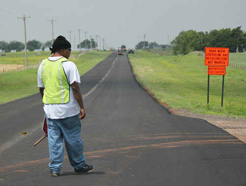 Hip - hopping flagman, Kingfisher Photo: Jane ONeill |
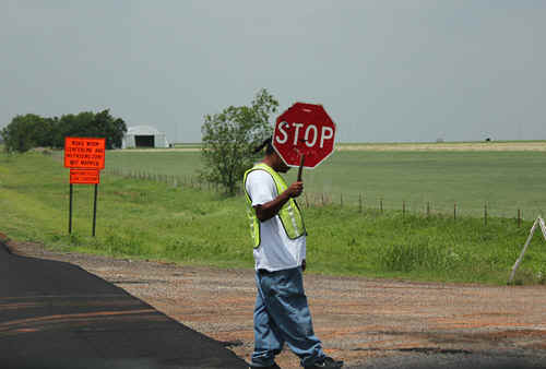 Still hip-hopping 10 minutes later.... Photo: Jane ONeill |
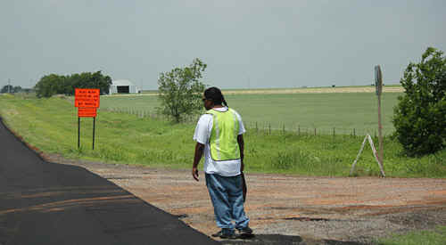 Photo: Jane ONeill |
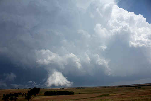
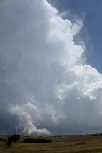
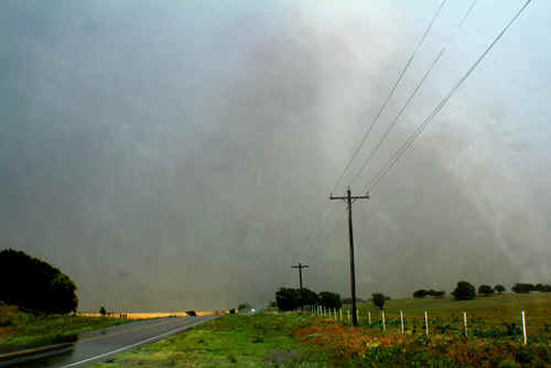
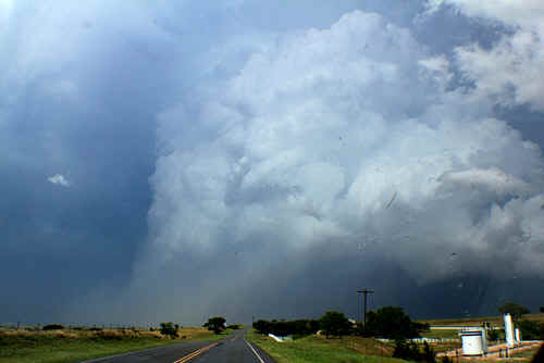
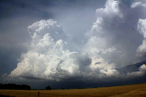
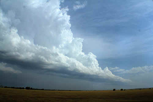
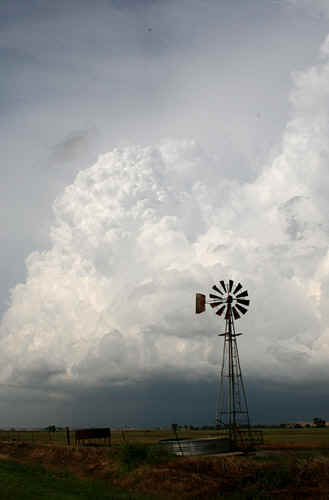
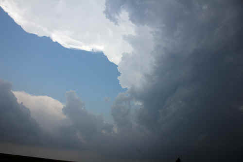 Jaw dropping updraft on the dryline eventually became the Canton tornadic supercell...Photo: Clyve Herbert |
|
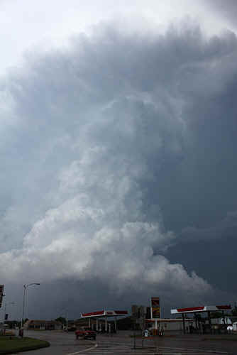
An 'RFD claw' - a cascading waterfall of vapour marks the RFD core dropping to the surface on the Canton supercell - western side...bloody remarkable...Photo: Clyve Herbert
|
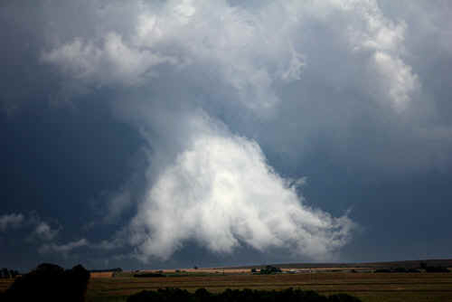 Closeup of the RFD claw...Photo: Clyve Herbert |
|
Jaw dropping updraft on the dryline eventually became the Canton tornadic supercell...Photo: Clyve Herbert |
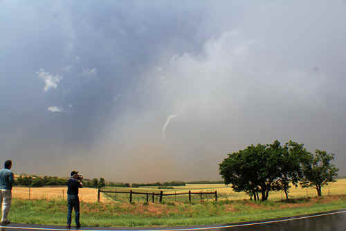
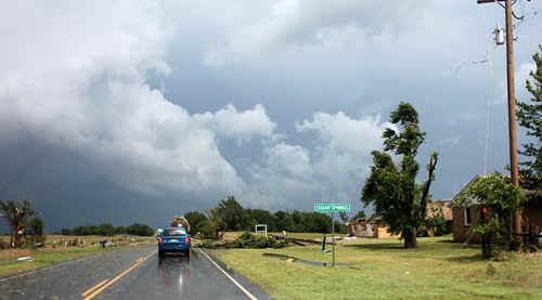
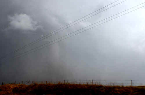 ...In this amazing tornadic sequence, we see the trunk of a strong tornado emerge from its rainwrap as it crosses the road in front of us, Cedar Springs, OK (near Fairview)...Photo: Jane ONeill |
 The passage of this tornado across the roadway was accompanied by an unearthly sound of what appeared to be screaming jumbo jet aircraft. Debris was falling out of the sky at this stage. Photo: Jane ONeill |
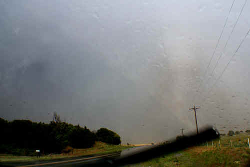 Photo: Jane ONeill
|
 Photo: Michael King |
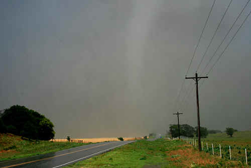 |
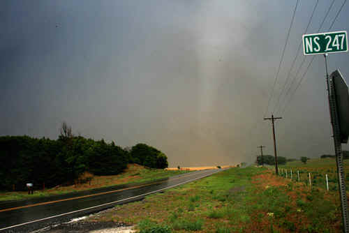 Photo: Michael King |
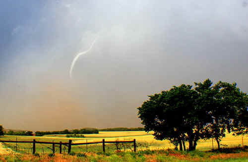
 The impressive image of the tornado moving NW after it croses the road and now emerges from the rainwrap. Photo: Michael King |
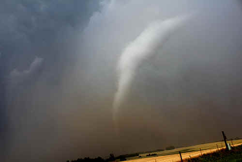 After crossing the road, the tornado emerged completely from its rainwrap as the mesocyclone sheared away to the NE. Photo: Clyve Herbert |
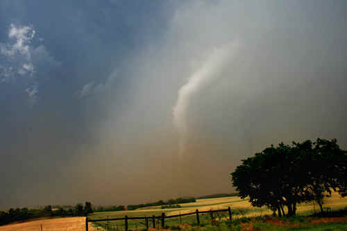 Photo: Michael King |
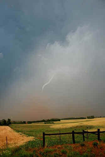 |
 As the main updraft core of the mesocyclone moved rapidly NE, the tornado almost instantly collapsed leaving a fading rope. The entire collapsing sequence was over in 10 seconds...and that was just as jaw dropping as watching the tornado crossing the road!! Photo: Jane ONeill |
 The dissapating tornado left a huge cloud of dirt and mud mixed with rain. Photo: Jane ONeill |
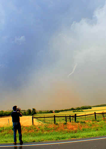 Photo: Jane ONeill |
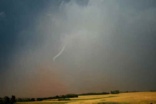 Photo: Michael King |
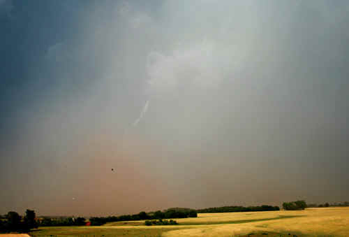 Photo: Michael King |
 The damage track of this tornado was barely 100 yards wide. Photo: Jane ONeill |
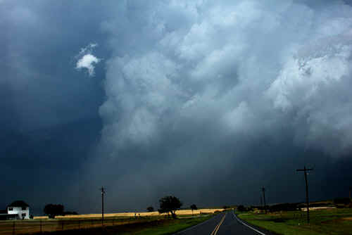 Photo: Clyve Herbert |
 This incredible image shows the rotating wall area - the rotating column extended into the anvil aloft. NE of Fairview Photo: Jane ONeill |
 A closer view of the rotating maelstrom NE of Fairview. Photo: Jane ONeill |
 Closeup of the rotating wall remnant. Photo: Jane ONeill |
 wall finally collapses, almost 30 miles NE of Fairview. A distorted feeder tail still remains. Photo: Jane ONeill
|
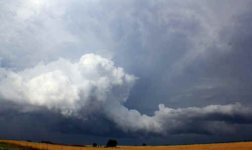
 Rapidly developing deep cumulus along a boundary line. Far north Oklahoma, Photo: Jane ONeill |
 Every supercell starts from somhwere - an interesting feeder band, northern Oklahoma. Photo: Jane ONeill |
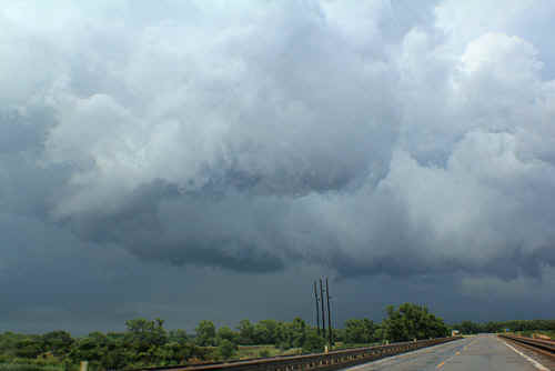
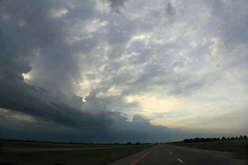 Sihouetted evening sky marks an approaching squall line McPherson, KS. Photo Jane ONeill |
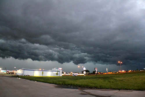
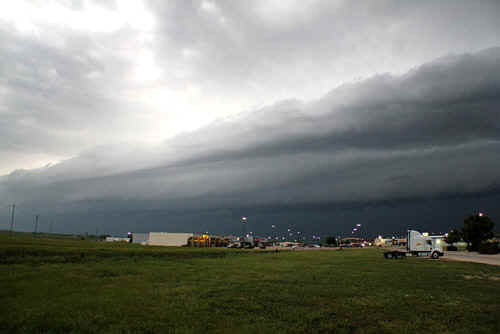 Linear squall line approaching McPherson, KS Photo: Clyve Herbert |
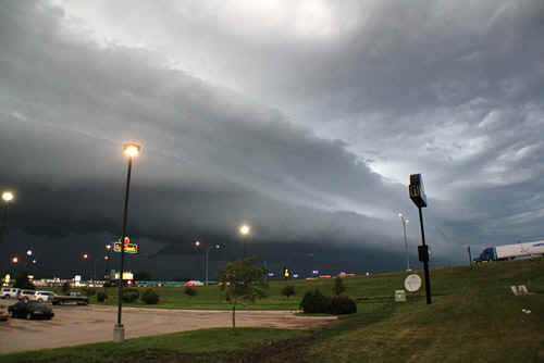 Locals at the restaurant were worried at the approach of this atmospheric 'apparatus'. Photo: Clyve Herbert |
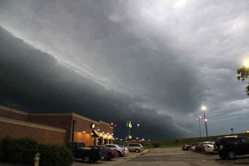 Photo: Clyve Herbert |
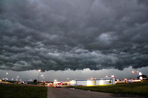
 An interesting arrangement of undulatus - subsidence behind the squall line. Photo: Clyve Herbert |
 |
 |
|
 |
|
| Stay tuned for tomorrow's episode... | |