| Day
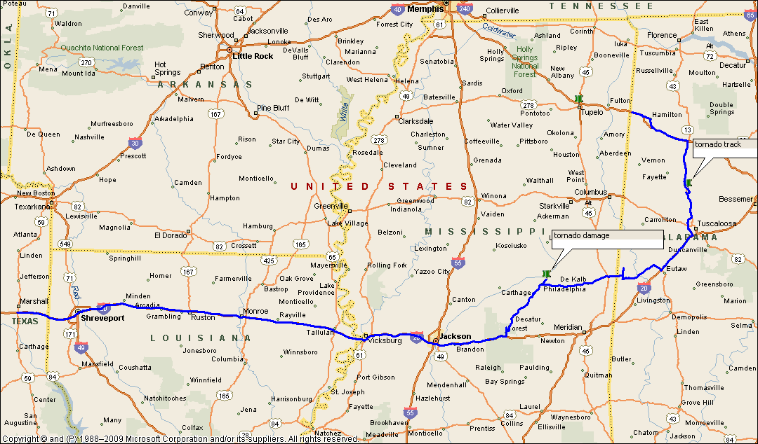
11: Marshall, TX to Fulton, MS - Forest, MS to Tuscaloosa, AL supercell This is our third visit to the USA...we love coming here and chasing storms...primarily we are stormchasers...we will chase and study anything that looks like a thunderstorm, we've never found a single storm the same as any other we've seen. We never expected to see what we saw in Alabama on this day!The Tuscaloosa tornado went beyond any scale of imagination...as we mentioned, we are stormchasers, we are not tornado chasers - a tornado is generally an accessory to a thunderstorm. We knew we would be behind the 8-ball chasing storms through Mississippi and Alabama - the forest is more like a jungle! We offer our sincere sympathies to those who have lost loved ones in this disaster. We won't forget meeting refugees and their harrowing stories of survival. Storm victims were arriving at our hotel in Fulton, MS all night. It was only then that the scale of this enormous event started to sink in. You feel as if you want to help but you really can't other than listen to the stories. It seems that some survivors just want to talk and some others just want to be silent. We probably won't chase storms in Alabama again.... A cold front was draping through NE Texas and moving steadily east. Huge amounts of tropical moisture were speeding north through Mississippi, Alabama and the southeastern states. A deep upper trough was digging into Texas bringing significant upper level cold air across the tropical air between the surface and 600hPa. The jet was progged to reach over 100knots across Mississippi and Alabama that evening. The cold front would lag behind the dynamics that would produce the greatest tornadic event in Alabama's history. We drove east from Marshall, TX on I20 and by early afternoon, convection was already getting organised over central Mississippi. Storms were initiating along the shortwave ahead of the frontal boundary. We left I20 near Forest to follow a strengthening storm. We struggled to keep up with the rainfree base area, primarily due to the roads. SW of Philadelphia, MS, this storm strengthened rapidly to produce a wall area. As we drove northwards, we came across an unexpected traffic jam - a truck ahead of us had jackknifed - we were forced to take an alternate route through the forest, sometimes on dirt tracks. Eventually we regained the road to Philadelphia..we managed to gain sight of the wall area again to our NE...the storm however appeared to be having some difficulty and the wall area broke down and reformed. We were later to find out that this storm disintegrated as the precursor to the Tuscaloosa storm developed on its SE quadrant, however this storm was not finished, and briefly produced a tornado just NE of Philadelphia. We found our road blocked yet again, this time by fallen trees and debris. We were forced back to Philadelphia where we take an alternate route towards Scooba. Just west of Scooba, what had been a secondary development on the SE quadrant of the supercell had strengthened rapidly and had developed a significant wall area that was showing rotation. Occasionally the wall would become rain wrapped and then reappear. It was definitely rotating significantly. Bolts of lightning sparked from the wall area. We continued east towards Scooba...although the roads were better here, these storms were getting a move on...and the wall area was moving in excess of 50 knots towards the NE. East of Scooba the storm continued to strengthen and was occasion ally poking funnels from the wall area. We cross the border into Alabama and drove northward to Geiger - it was here we passed the Dominator heading rapidly south... Just east of Geiger the wall area put down a large funnel...and we think ground contact was made. The storm continued to move rapidly NE and we altered our strategy to head south to I20 and then head NE paralleling the storm. Even at 70mph, we were having difficulty overhauling this monster of a supercell as its top punched more than 50,000', it was tapping into the full force of the jetstream (110knots+!). As we approached within 10 miles of Tuscaloosa, we started to see trees and debris strewn about...traffic slowed, eventually stopped - we could not progress any further NE. Eventually we slowly moved to an overpass which connected Hway 49 to the NW - this is where the Tuscaloosa super megatornado started to do its worst work...we found semi trailers and trees strewn about. Emergency vehicles were responding. With no further progress, we abandoned the chase and headed N along Hway 49 but that wasn't the end of our dilemma...there was no power and we came across narrow paths of destruction for the next 20 miles. We were forced to again find alternative routes, and 3 hours later we managed to clear the area. We finally headed NW on Hway 22, dissecting the cold front as it sped rapidly through Alabama from the western border...a line of vigorous thunderstorms had developed along the cold front with vigorous lightning and hailstones, but the cold frontal band was very narrow,barely 5 miles wide... Dissecting the cold front we went from air of tropical maritime origin into air of Canadian origin...the contrast between the 2 air masses was extraordinary. Now we had clear vistas as far as the horizon and the sky was blue again, not milky white. We finally arrived at Fulton where we overnighted. Through the night, dozens of refugees appeared from Alabama seeking shelter...some were injured and some had lost everything.... |
|
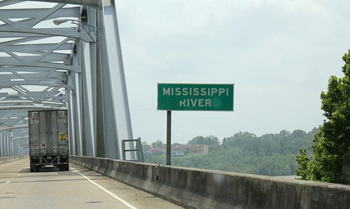 The Mississippi River is big! You could probably fit 100 Murray Rivers into it... |
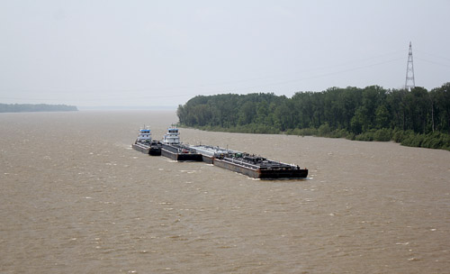 Not only could you fit 100 Murray Rivers, but you could fit 100 barges as well..we were impressed!! |
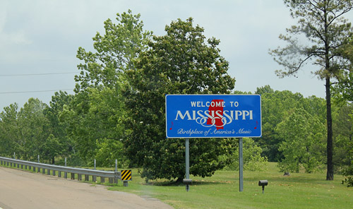 Our travelling to day took us from Texas through Louisiana, Mississippi and into Alabama |
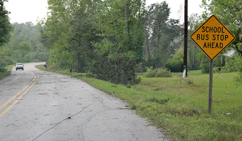
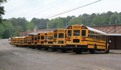 Even small town schools have an impressive lineup of the iconic American school buses.
|
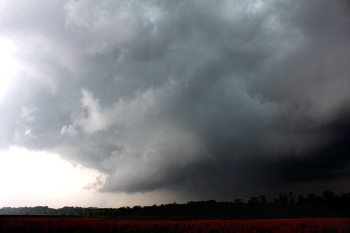
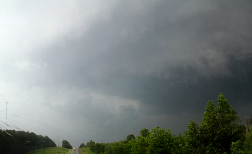
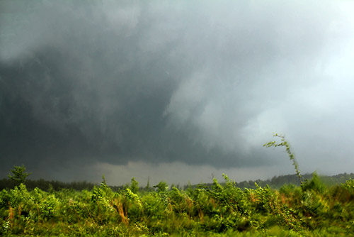 Wall cloud takes shape SW of Scooba.
|
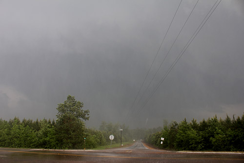
 Partially rainwrapped wall development area. |
 West of Scooba we find a partially rainwrapped wallcloud with was to be the precursor to the Tuscaloosa mega cell. |
 Inside the rain wrap, the wallcloud was impressive.At this stage the wall area was generating brief spinups and we came across a number of narrow damage paths. |
 We came across sporadic damage paths north of Philadelphia which blocked our passage
|
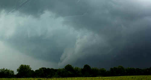
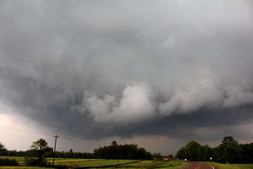
East of Scooba, the wall started to get its act together big time, with rapid rotation. |
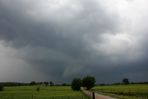 The central core of this mega cell was travelling at close to 100kmh (60mph) - it was almost impossible to keep up with especially with trees and branches across the roadway hindering our progress.At this stage we had plotted the wall area to go directly through Tuscaloosa and onto Birmingham. |
Near Geiger, the supercell passes from Mississippi to Alabama. The wallcloud becomes larger and starts to drop significant funnels. We suspect the first major touchdowns occurred just SE of Geiger. |
 East of Geiger, Alabama |
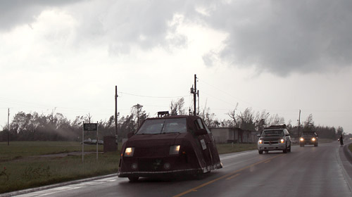
The Dominator convoy heading south to intercept the Tuscaloosa megacell |
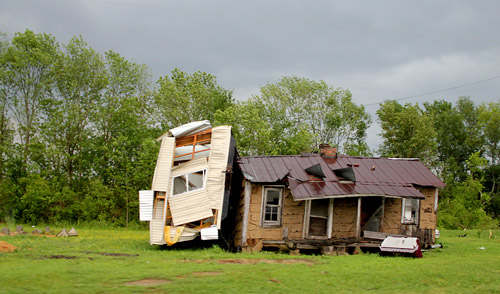 This area of Alabama had been ravaged by tornadoes in May 2010. In some localities, small towns had been abandoned with the chaos remaining on the ground. |
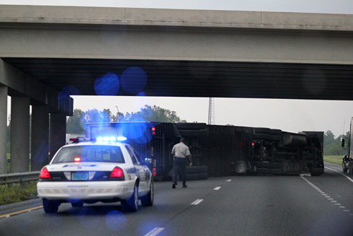
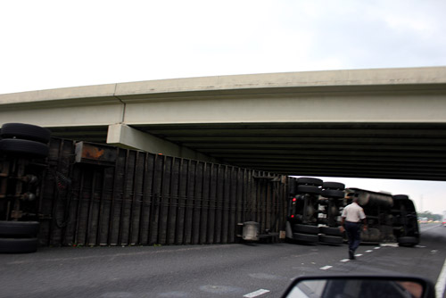
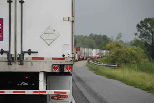 Interstate blocking up SW of Tuscaloosa after a tornado had crossed it |
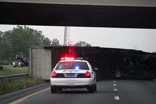 We found numerous semis tossed across the Interstate - our chase was ended (this was on the southern quadrant fringe of the tornado) |
 |
 |
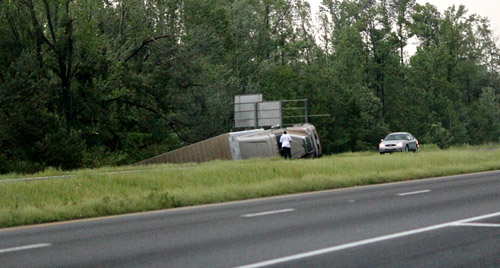 This 18 wheeler was tossed into a ditch - what hope would you have in your car? |
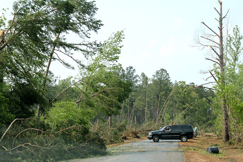
 Numerous country roads were debris strewn, cutting of escape routes |
 Half of Alabama lost power - we found downed powerlines scattered across many country roads |
 West of the main tornadic area, a cold front moved quickly across the border into Alabama clearing out the rest of the tropical moisture |
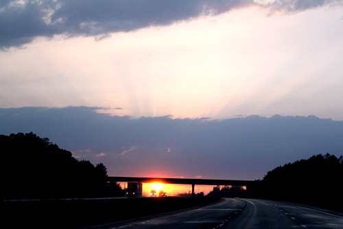 The change from murky tropical air of Gulf origin to the clear air of Canadian origin was remarkable - temperatures dropped almost 20F behind the cold front. |
 |
|
| Stay tuned for tomorrow's episode... | |