| Day
8: 29th April, 2010: After overnighting at North Platte, the cold front had
dropped from NW Nebraska to SE Nebraska and trailed across NW Kansas. Loading the car, we
noticed a distinct change from the balmy 80's of the previous day (26C) to a struggling
40F this morning (5C) - it certainly got us hopping about to keep warm! If you are doing a
roadtrip through the States, you will find good quality motels along interstate highways
(I Roads) - they aren't too expensive, mainly $60 - $90 per night for 2 or more people.
They will also throw in a reasonable breakfast comprising toast, egg, occasionally bacon,
cereal, coffee, tea and fruit juice. You can also pig out on donuts & waffles if you
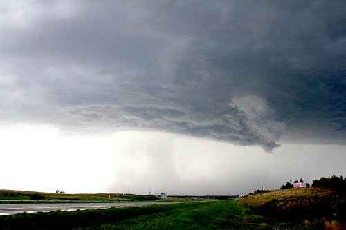
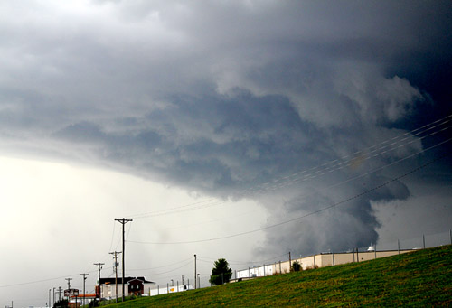
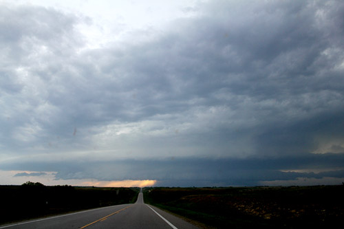
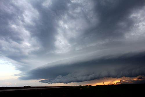
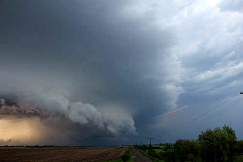
want. Today, our plan is to race east to York, Nebraska along I-80 and drop south along Route 81 to Salina, Kansas. This area is progged for significant storm activity during the late afternoon. Intensified storms here are expected to co-ordinate with deep Gulf moisture just ahead of an expected cold front. Within 4 hours, we are driving south into northern Kansas in clear skies. By early afternoon, apart from a milky appearance, the skies are completely clear - temperatures in the low 80's, dewpoints in the low 60's. We drive west of Salina, and plonk near a low hilly area with good vistas. Around 2pm, we note a narrow line of fractocumulus suddenly appearing at our location. As temperatures climb into the mid 80's, dewpoints are following, also increasing into the mid 60's. The cap here is not overly strong and soon, larger towers develop at our location. Pretty soon, they start to glaciate for the first relatively weak storm, so our mad racing storm day commences. When stuff goes off here under these conditions, expect something big! We weren't disappointed! We race northeast following the first storm which quickly became severe....and promptly collapsed.....pretty soon, another storm develops on its northwest quadrant and rapidly intensifies and becomes the dominant storm for the next hour or so. Once these storms tap into the 40,000' levels, they will often accelerate northeast - this one was receding NE at 70kmh! We are partially trapped on country roads and get caught up in a town called Minneapolous with 20mph road speeds! then emerge into clear country to watch a standalone backshearing storm moving into far northern Kansas. We chase for a while but then notice another storm developing to our west - new storms keep banking backwards towards the southwest - we latch onto a storm SW of Concordia which quickly becomes severe with great rainshafts and truckloads of lightning. The storm organises a large rainfree base in its southern quadrant and then develops a wallcloud passing over the town of Concordia. We follow east and view a rather scrappy but rotating wallcloud - other chasers in the area photograph and video brief funnels and possible tornadoes. The storm finally starts to weaken out and we view another, even better storm to the west. This time we manage to get onto Highway 36 (The Pony Express Highway). As we drive west towards Belleville, an elongated dark base appears on the horizon...at first, it didn't appear to be too menacing, but as we approach, we can start to see structure!! What appears as a beaver tail on the south side of the storm, turns out to be an RFD undercut. The beaver tail has an elongated tail feeding in from the east and arcing around the west side of the storm. We crest a rise and there before us is the whole of the storm in its entirety. We are looking down on one of the most magnificent storms we have ever seen! We pull onto a side road and grab our gear and set up. The main updraft vault towers into the anvil and is sparking lightning on the underside of its northeastward pointing anvil almost continuously. We can see the wallcloud rotating and a dark area appears under the base - we suspect a tornado is rainwrapped. We watch the unfolding Kansas plains supercell gradually become overtaken by its RFD outflow and eventually becomes an outflow dominated storm prior to weakening. We finally arrive at Belleville exhausted and searching for motels...but are unsuccessful. We head south to Concordia and find a great hotel and on the upper floor we spend the rest of the late evening watching the cold front plough into the near gale force southerly jet and produce several hours of strobe lightning along its alignment. |
|
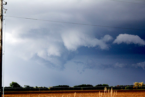
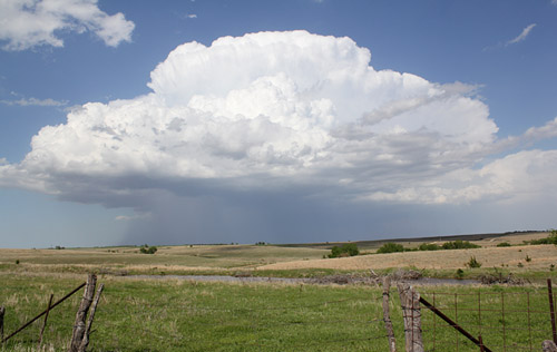 The first of the major storms of the day - a stand alone that eventually became a supercell, west of Salina |
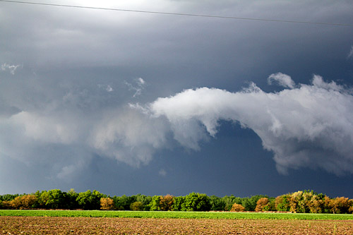
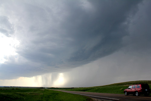 The second major storm of the day started as a linear affair with a potent updraft on its southern side - west of Concordia |
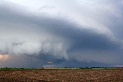
 The Concordia storm maintained a strong rain free base for almost 30 minutes |
 As the storm passed over Concordia, it rapidly developed a wallcloud |
 The underlying base of the Concordia supercell was marked by sporadic rotation |
 The Concordia supercell starts to weaken. |
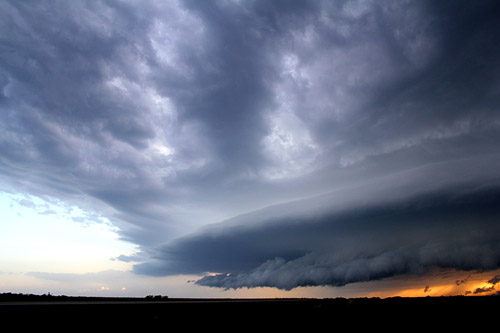
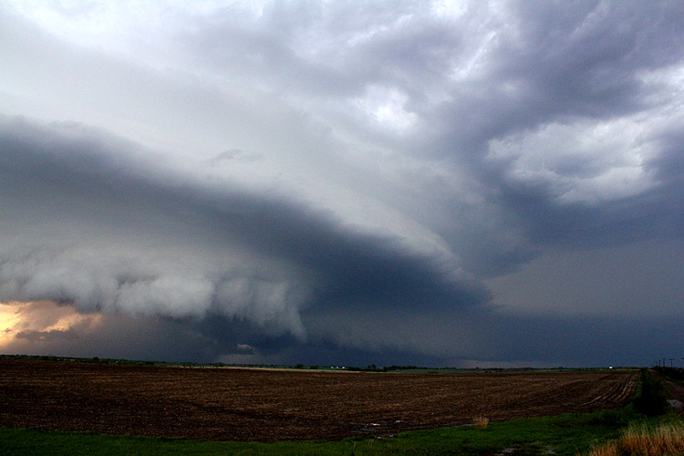
 The structure of the Belleville supercell as we approach from near 20 miles to the east - the RFD on the left and a beaver tail on the right. |
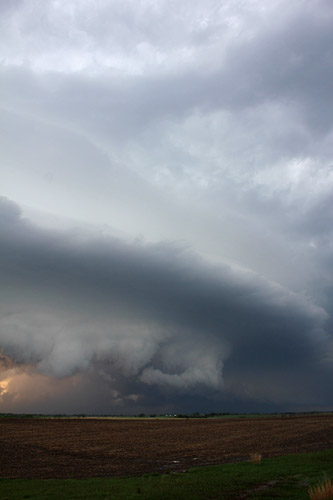
  Structure of the RFD undercut, southern side - Belleville supercell |
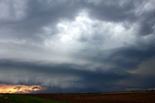 Looking towards the meso core - the left side was rotating towards up while the right side was rotating away towards the west |
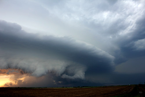
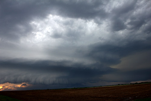 In this image, the curving inflow beaver tail is on the right. The main updraft vault can be seen rising above the meso (central dark area) |
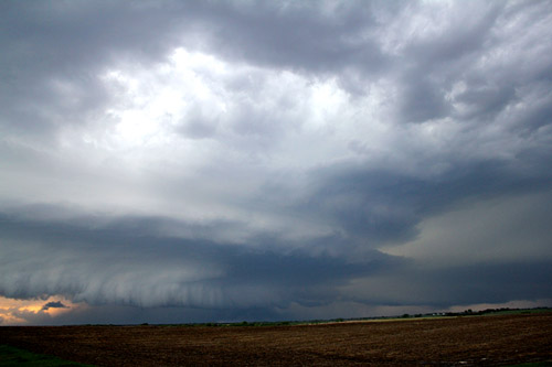 Closer view of the Belleville tornadic supercell core |
 The RFD was feeding in from the left and the central dark area under the wallcloud we suspect hides a rainwrapped tornado. At this point the Belleville supercell had a tornadic signature on radar |
 View of the wallcloud and very interesting inflow structure |
 The RFD commences its dominance |
 The glowing area to the left is the RFD undercut - at this point the wallcloud becomes unstable. |
 |
 The RFD now appears to have become the dominant feature of this storm. The Belleville supercell weakened rapidly after this image. |
|
| Stay tuned for tomorrow's episode... | |