| Day
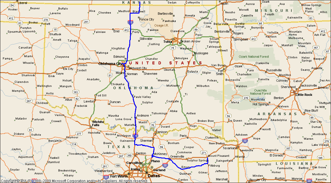
15: Arkansas City, KS - Mt Pleasant, TX: The Bettie - Hughes Springs Tornadic
Supercell Australians find American town names quite weird...and we find ourselves confounded by the number of times Americans use the same town names across the United States. For instance, we think there are in the order of 15 or 17 Washingtons, and we know there is more than one Philadelphia. Along the I70 between St Louis & Kansas City you will find a town called Concordia....then if you go west of Kansas City on I70 you will find another town called Concordia! That's in Kansas! The other dilemma is that Kansas City isn't in Kansas at all, it's in Missouri! We overnighted in Arkansas City, which is not in Arkansas, but in Kansas...and no-one in Arkansas City calls it by that name - they call it Ark City. We stayed in Ark City at a not-so-Best Western Hotel....I spotted a rather large hairy spider on the wall, which interestingly didn't move that night and was there the next day....we lined up for breakfast in the Atrium, where the swimming pool is surrounded by all sorts of jungly trees and shrubs, and the overwhelming stink of chlorine. I ventured over to the hot breakfast section where I noted that the scrambled eggs were congealed into large lumps and had the consistency of half dried concrete. That may have not put me off so much as the mouldy green colour! I skipped the eggs and the strange looking wiggly sausages, and went for the plain old toast. With the bread like cardboard, I suppose it doesn't matter as it's going to be toasted anyway. We were startled by a skinny old woman who came out, looking like the witch in the Wizard of Oz, which was appropriate considering we were in Kansas. After foregoing the mouldy green eggs, we found there were no teabags.....we asked the wicked witch form the east if she had any teabags...she promptly replied (as if rehearsed), "we won't get any tea until the truck arrives" - we were somewhat befuddled - she disappeared into her little cave, and we settled for coffee....we were happy to escape the not-so-Best Western Ark City. We pointed our Chevy Traverse south. Despite our bad experience at the hotel, Ark City is a pleasant town, and we always enjoy passing through it. Our plan today is to head south on I35 to Texas with a short stopoff at Oklahoma City. For the weatherbuff readers, a cold front had moved quickly through northern Oklahoma overnight, dropping temperatures from the 70'sF to the 40'sF (25C to 5C). The front was expected to move quickly into north Texas and then stall. Interstate 35 is a busy freeway connecting major cities such as Wichita, Oklahoma City and Dallas. You can drive on I35 from the far south of the USA to Duluth, Minnesota which is near the Canadian border. After passing through Oklahoma City, we pass south through Norman and between Norman and Ardmore we are confronted by hundreds of motorcyclists...at least they all had their helmets on. Incredibly a number of states in the USA don't mandatorily enforce the wearing of helmets on motorcycles!! Our nickname for motorcyclists without helmets is 'watermelon heads' - that's not to describe the person riding the bike in a derogatory way, we all know what happens to watermelons when you drop them from 2 feet not to mention what happens to them when you drop them at 70mph! Soon we are passing the border between Oklahoma and Texas, we're going to cut across country towards Canton. This area has been quite active over the last week and is projected to remain storm active for next 2 or 3 days. The cold front now passing into northern Texas is expected to stall. Now in northern Texas we are well into the tropical moisture from the Gulf - temperatures have risen into the mid 80'sF and humidity sits at 65%. However conditions are very hazy and the unfortunate aspects of this part of Texas are trees and windy roads. We continue east and eventually find ourselves in thelate afternoon at Mt Pleasant. A couple of storms have kicked off along the frontal boundary near Dallas, but these are not the storms we are looking for...we are looking for the discrete isolated activity in the warm airmass away from the frontal boundary. We spot a small echo to our SW near Canton...it's rather late and after 6pm, but the small yellow echo grows explosively! We have a discrete storm that will soon become a supercell! We head west of I30 and then SW on Hwy 37 - we eventually catch sight of the wall area of this storm moving NE, but light is fading and we need to get into position. We struggle with trees and roads again, but soon find a good viewing area and watch the wallcloud rotate over a nearby hill and approach our location. Thick bolts of lightning dance around the wallcloud area, deep booming cracks of thunder echo across the valley almost constantly...we start to photograph and video the rotating wall and golfball hail begins to fall. Occasionally funnels spin under the wall area, we retreat east to another clear area and watch the wall area capped with a 'pile of plates' move northeast of our location. A strong beaver tail appears on the southeastern quadrant and an inflow jet passes tour north, feeding into the wall area. With fading light we follow the rotating wall northeast, and eventually find ourselves near Bettie where the storm puts down a number of funnels, some touch down for brief periods, but the light is extremely poor. We eventually circle the wall in the last of the light, illuminated with frequent lightning flashes we see funnel dropping and receding. 1 small funnel passes with 200m of our vehicle and we are jostled by squally winds. It's too dangerous and dark and we let the storm pass NE of our location. Not long after, we give up the chase..Hughes Springs is damaged by an EF2! We dribble north to our hotel at Mt Pleasant for a restful night.... |
|
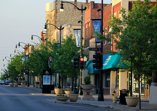 Pretty main street, Arkansas City, Kansas |
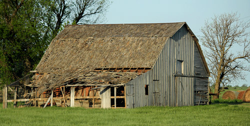 There are numerous run down buildings and barns in central Oklahoma - they make good photographic studies, giving you a sense of time. |
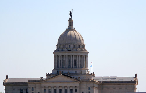 Oklahoma State Capitol Building...spot the Indian! |
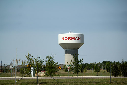 For stormchasers in Australia...ground zero for severe storm research, Norma, Oklahoma |
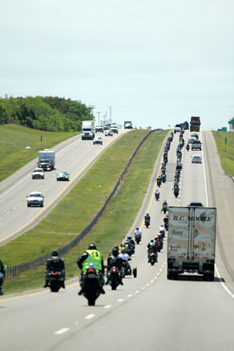 Bikie's day out! near Ardmore, Oklahoma |
 ..not the back end of a supercell! we wondered where the hell she got her jeans from...... |
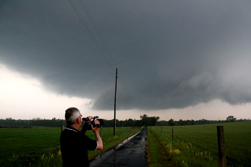
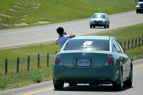 Some people will do anything to get a good photo....and they aren't necessarily stormchasers |
|
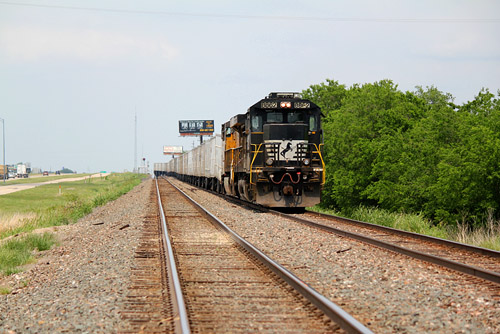 Unusual lashup of locomotives with an old SD40 leading, near McKinney, Texas |
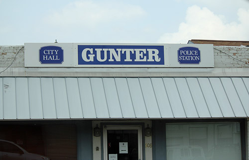 Small town headquarters.. |
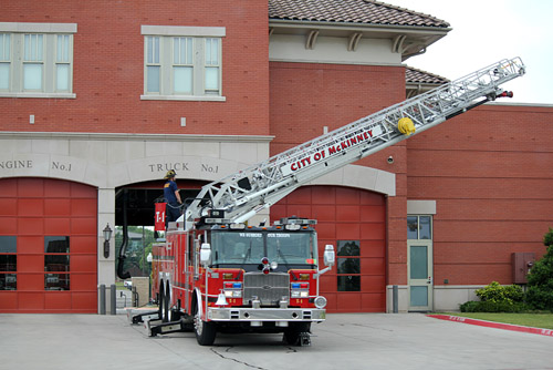 Boys playing with toys! near McKinney |
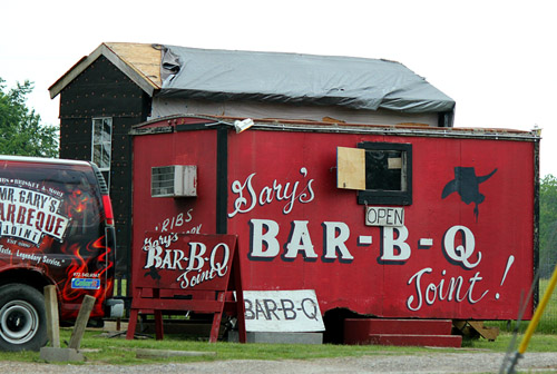 No expense spared at this restaurant! |
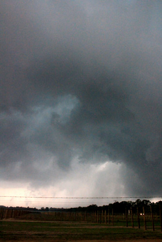
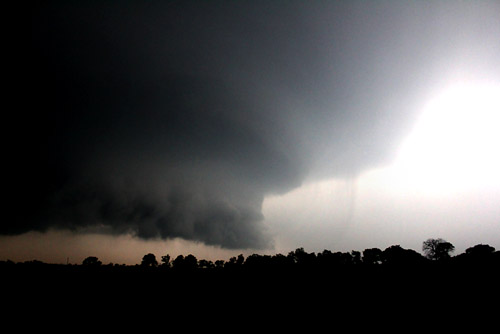
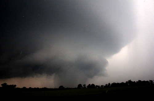
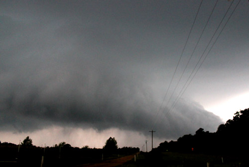
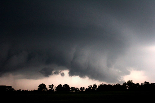 Developing tornadic supercell NW of Canton, Texas |
|
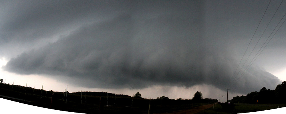
 Near Bettie, TX the storm intensifies producing a remarkable wallcloud |
 |
|
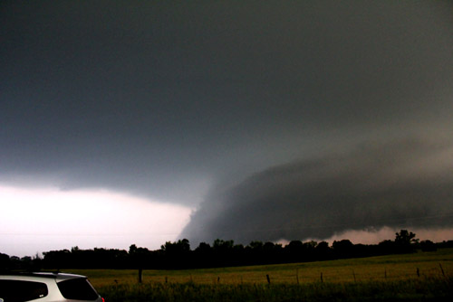
 Developing beaver tail, SE quadrant. |
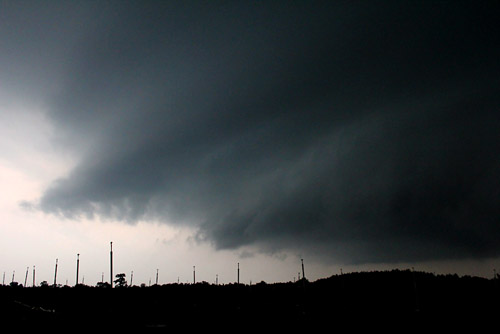
 Rapidly rotating meso on the right hand side.... |
 |
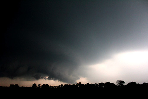
 Rain wraps into the tight mesocyclone and we suspect a tornado is embedded. |
 This area (beaver tail) represented the very strong southerly inflow into the storm |
 The SE quadrant showing southerly inflow jet ascent area. |
|
 The NE flank had a rapidly moving low level jet streaming in from the NE into the meso |
 Rap;id rotation appeared in the meso area and would occasionally appear to be rain wrapped. |
|
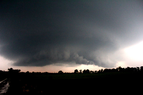
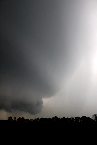
In a weakening phase |
|
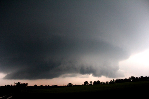
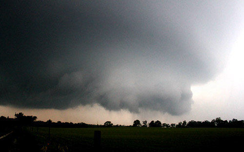
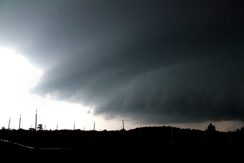
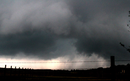
Spectacular Bettie supercell |
|
 |
|
| Stay tuned for tomorrow's episode... | |